
Jingpohu
Jingpohu (镜泊湖, Jìngpō Hú) — "Mirror Lake" — is China's largest alpine barrier lake, formed roughly 10,000 years ago when volcanic eruptions blocked the Mudan River (牡丹江, Mǔdān Jiāng), creating a 45-kilometer-long lake in the mountains of southeastern Heilongjiang province. The lake's name is literal: on calm days, the water is a near-perfect mirror, reflecting the volcanic cliffs and forested hills that surround it. The headline attraction is the Diaoshuilou Waterfall (吊水楼瀑布, Diàoshuǐlóu Pùbù), a 25-meter drop where the lake's outflow plunges over a black basalt cliff — one of the few volcanic-rock waterfalls in the world — and in winter freezes into a 40-meter-wide ice curtain that attracts ice climbers and photographers. The other draw is the Underground Forest (地下森林, Dìxià Sēnlín), a lush forest growing inside the crater of an extinct volcano, reached by descending stone steps into what feels like a hidden world. Jingpohu is a UNESCO Global Geopark, and the area also contains relics of the Bohai Kingdom (渤海国, Bóhǎi Guó, 698-926 AD), a medieval Koreanic-Manchurian state whose capital was near the lake. The honest downside: Jingpohu is remote — 4-5 hours from Harbin by road — with limited infrastructure, variable water levels (the waterfall is reduced to a trickle in dry years), and almost no English spoken. It is at its best in summer (June-September) when the waterfall flows, the lake cruises run, and the Underground Forest is green; in winter, it transforms into a frozen landscape of ice waterfalls and snow-covered volcanic cones, beautiful but logistically challenging.
Why Jingpohu in 2026.
China's largest alpine barrier lake, Mirror Lake reflects volcanic cliffs, a rare lava-rock waterfall thunders year-round, and an underground forest grows inside an ancient crater.
Quick Answer
Jingpohu (镜泊湖, Jìngpō Hú) — "Mirror Lake" — is China's largest alpine barrier lake, formed roughly 10,000 years ago when volcanic eruptions blocked the Mudan River (牡丹江, Mǔdān Jiāng), creating a 45-kilometer-long lake in the mountains of southeastern Heilongjiang province. The lake's name is literal: on calm days, the water is a near-perfect mirror, reflecting the volcanic cliffs and forested hills that surround it. The headline attraction is the Diaoshuilou Waterfall (吊水楼瀑布, Diàoshuǐlóu Pùbù), a 25-meter drop where the lake's outflow plunges over a black basalt cliff — one of the few volcanic-rock waterfalls in the world — and in winter freezes into a 40-meter-wide ice curtain that attracts ice climbers and photographers. The other draw is the Underground Forest (地下森林, Dìxià Sēnlín), a lush forest growing inside the crater of an extinct volcano, reached by descending stone steps into what feels like a hidden world. Jingpohu is a UNESCO Global Geopark, and the area also contains relics of the Bohai Kingdom (渤海国, Bóhǎi Guó, 698-926 AD), a medieval Koreanic-Manchurian state whose capital was near the lake. The honest downside: Jingpohu is remote — 4-5 hours from Harbin by road — with limited infrastructure, variable water levels (the waterfall is reduced to a trickle in dry years), and almost no English spoken. It is at its best in summer (June-September) when the waterfall flows, the lake cruises run, and the Underground Forest is green; in winter, it transforms into a frozen landscape of ice waterfalls and snow-covered volcanic cones, beautiful but logistically challenging.
| Worth visiting | Yes, for the rare volcanic-rock waterfall and the surreal Underground Forest — but accept that it is remote, infrastructure is basic, and English is almost nonexistent. |
|---|---|
| Recommended days | 2-3 days |
| Best time to visit | June-September for the flowing waterfall and lake cruises; January-February for the frozen ice waterfall and winter photography |
| Daily budget | $35 (backpacker) / $100 (mid-range) / $260+ (luxury) |
| Family friendly | Good in summer — lake cruises, easy walking paths, the waterfall, and the Underground Forest all work for families with children 6+ |
| Solo friendly | Challenging solo — the sites are spread out, public transport is minimal, and a driver or tour is essential. Best with a Chinese-speaking companion. |
| Airport | Mudanjiang Hailang Airport (MDG) — 1.5 hours by road from Jingpohu. Harbin Taiping International Airport (HRB) is 4-5 hours by road. |
| High-speed rail | Yes — Mudanjiang Station (牡丹江站) is 1.5 hours from Harbin by HSR (¥100-150 second class), then 1.5 hours by bus or taxi to Jingpohu scenic area. |
| Language | Mandarin with Northeastern dialect (东北话, Dōngběi huà); English is essentially nonexistent |
| Currency | CNY (¥) — Alipay and WeChat Pay accepted at the main ticket office and larger hotels; carry ¥500+ cash for smaller sites, boat rentals, and local restaurants |
| Time zone | China Standard Time (UTC+8) |
| Last updated | 2026-06-18 |
Want a Jingpohu plan built for you?
Jump to:
Mirror Lake·Diaoshuilou Waterfall·Underground Forest·Lake Cruises·Bohai Ruins·Getting Around·Where to Stay·Itineraries·Weather·Food·Tips & Warnings·Geography·Mudan River·Bohai Kingdom·Ice and Snow Festival·UNESCO Geopark·Photography·Wildlife·Waterfall-Diving Tradition·Compared to Other Heilongjiang·Emergency Contacts·FAQ
Why visit Jingpohu? Is Mirror Lake worth the journey?
Jingpohu occupies an unusual position in Chinese tourism: it is a UNESCO Global Geopark, a major domestic summer destination, and almost completely unknown to foreign travelers. The lake and waterfall are genuinely beautiful — the sight of water plunging over a black basalt cliff into a turquoise pool, with forested hills reflected in the lake beyond, is one of the most photogenic natural scenes in northeast China. The Underground Forest, less visited and harder to reach, is stranger and more memorable: descending stone steps into a 500-meter-wide crater filled with ancient pines feels like entering a landscape from a Miyazaki film. The lake itself is China's largest alpine barrier lake — 45 kilometers long, up to 6 kilometers wide, and 40 meters deep at its deepest point — and was formed when volcanic eruptions blocked the Mudan River roughly 10,000 years ago. The water is extraordinarily clear (visibility of 5-10 meters), the surrounding hills are forested with Korean pine and Manchurian ash, and on calm days — which are frequent in summer — the water is a near-perfect mirror. The name is not marketing; it is descriptive. The Bohai Kingdom ruins add a historical layer that most Chinese nature destinations lack. The Bohai state (698-926 AD) was a sophisticated medieval kingdom with strong cultural and political ties to Tang-dynasty China, Korea, and Japan. Its capital, Sanggyeong, was one of the largest cities in East Asia at its peak, and the surviving ruins — palace foundations, a stone pagoda, city walls — are a tangible link to a nearly forgotten civilization. The honest downsides: Jingpohu is remote, the infrastructure is basic, English is nonexistent, and the water levels are variable. In dry years (which have become more frequent in the 2020s), the waterfall can be reduced to a disappointing trickle by late summer. The lake cruises are pleasant but not spectacular — this is not the Li River or the Norwegian fjords. And the spread-out sites (the Underground Forest is 50 km from the main lake area) mean you need a car and driver, which adds cost and complexity. Jingpohu is best visited as part of a larger Heilongjiang itinerary, combining with Harbin (4-5 hours away) or Mudanjiang (1.5 hours away), rather than as a standalone destination.
How was Jingpohu formed: the volcanic geology of Mirror Lake?
Jingpohu is a barrier lake (堰塞湖, yànsè hú), formed when volcanic eruptions blocked the Mudan River roughly 10,000 years ago, during the Holocene. The eruptions came from a cluster of volcanic vents in the Jingpohu Volcanic Field, which is part of the broader Changbaishan Volcanic Belt that extends across the China-North Korea border region. The lava flows dammed the river in several places, creating a long, narrow lake that filled the river valley behind the lava dam. The lake is 45 kilometers long but only 1-6 kilometers wide, following the contours of the drowned river valley. The depth ranges from 10 to 40 meters, and the water is fed by the Mudan River and numerous mountain streams. The outflow — where the lake drains over the lava dam — is the Diaoshuilou Waterfall, a 25-meter drop over a black basalt cliff. The waterfall is one of the world's few volcanic-rock waterfalls; most major waterfalls flow over sedimentary or metamorphic rock, and the black basalt gives Diaoshuilou a distinctive visual character. The volcanic field also produced the lava tube caves near the lake (the Jingpohu Karst Caves — technically lava tubes, not karst) and the volcanic craters that host the Underground Forest. The main crater containing the Underground Forest is about 500 meters in diameter and 130 meters deep, formed in an eruption roughly 10,000-20,000 years ago. The crater's microclimate — cooler, wetter, and sheltered from wind — supports a forest ecosystem that differs from the surrounding plateau, with ancient Korean pines, Manchurian ash, and rare ferns that have grown undisturbed for centuries. The Jingpohu Volcanic Field is considered dormant, not extinct — the most recent eruption was about 5,000 years ago, and the broader Changbaishan system (including the famous Changbaishan/Tianchi volcano) had its last major eruption in 946 AD, one of the largest volcanic events in recorded history. There is no indication of imminent activity at Jingpohu, but the volcanoes are monitored.
How to get to Jingpohu from Harbin, Mudanjiang, and beyond?
Jingpohu is most easily reached via Mudanjiang (牡丹江), a city of 2.5 million people about 1.5 hours from the lake by road. Mudanjiang is connected to Harbin by high-speed rail (1.5 hours, ¥100-150 second class, frequent departures). From Mudanjiang Station, buses run to the Jingpohu scenic area (1.5 hours, ¥30-40, roughly hourly in summer) or you can hire a taxi or DiDi (1.5 hours, ¥200-300). From Harbin directly: a private car or DiDi takes 4-5 hours (¥1,000-1,500 one-way). There are also direct tourist buses from Harbin to Jingpohu during the summer season (June-September), taking about 5 hours and costing ¥120-160 — these are the cheapest option but infrequent and Chinese-only. From Mudanjiang Hailang Airport (MDG): flights from Beijing (2 hours, from ¥800), Shanghai (3 hours, from ¥1,200), and Seoul (2 hours, from ¥900). From the airport, it is about 1.5 hours by road to Jingpohu (taxi ¥200-300). The Jingpohu scenic area has two main zones: the lake and waterfall area (the primary tourist zone) and the Underground Forest (50 km to the northwest, a separate site). Most visitors base themselves at the lake area and take a day trip to the Underground Forest. A car and driver is essential for visiting both zones — arrange through your hotel or at the scenic area visitor center. Practical recommendation: HSR from Harbin to Mudanjiang (1.5 hours), overnight in Mudanjiang if arriving late, then bus or taxi to Jingpohu the next morning. This is faster, cheaper, and more reliable than the direct 4-5 hour drive from Harbin. Alternatively, fly into Mudanjiang Airport if coming from further afield.
How to get around Jingpohu: the lake zone, Underground Forest, and transport?
The Jingpohu scenic area is spread across two main zones about 50 kilometers apart, and there is no shuttle bus connecting them. You need a car and driver, or you need to join a tour. The lake and waterfall zone is compact and walkable. The main wharf, the Diaoshuilou Waterfall, the visitor center, and the lake-viewing platforms are all within a 1-2 kilometer radius on well-paved paths. The Mao Gong Mountain viewpoint, the lakeside walking trails, and the karst caves are a short drive or a 30-40 minute walk from the main area. Lake cruises depart from the main wharf and cover the lake scenery. The Underground Forest is 50 km northwest of the lake zone, about a 1-hour drive on a paved but winding road. There is no public transport to the Underground Forest — you need a car and driver (¥400-600 for the round-trip, including waiting time). Some hotels can arrange this. The Underground Forest site itself involves descending and climbing stone steps (about 500 steps down into the crater, 500 back up), so comfortable shoes and reasonable fitness are required. The Bohai Kingdom ruins are about 30 km east of the lake area, a 40-minute drive. A taxi or driver for the round-trip costs ¥200-300. Transport within the scenic area: electric shuttle buses (¥20-30 per day for unlimited rides) connect the main sites in the lake zone — the wharf, the waterfall, the visitor center, and the main hotels — during summer (roughly 08:00-17:00). Outside summer, the shuttle service is reduced or suspended, and walking or a private car is necessary. Practical summary: arrive at the lake zone, use the shuttle bus or walk for the lake and waterfall, hire a driver for the day trip to the Underground Forest, and hire a driver or taxi for the Bohai ruins. Budget ¥600-900 for transport within the scenic area over 2-3 days.
Where to stay in Jingpohu: lakeside hotels, Mudanjiang, and the scenic area?
Accommodation at Jingpohu is concentrated in two zones: the scenic area near the lake (atmospheric, limited options, more expensive) and Mudanjiang city (wider choice, lower prices, 1.5 hours away). The Jingpohu scenic area has a handful of hotels and guesthouses clustered near the main wharf. The Jingpohu Hotel (镜泊湖宾馆, ¥400-800 per night as of June 2026) is the most established option, a 1950s-era lakeside hotel that has hosted Chinese political leaders and has a faded mid-century charm. The Jingpohu International Hotel (镜泊湖国际酒店, ¥500-1,000) is newer and more comfortable but further from the lake. Several smaller guesthouses and farm-stays (农家乐, nóngjiālè, ¥150-300) in the villages near the scenic area offer simple rooms and home-cooked meals. Staying in the scenic area means you can see the lake at sunrise and sunset when the day-trippers are gone — the lake in early morning mist is the best Jingpohu experience. Mudanjiang city (牡丹江市, 1.5 hours from the lake) has the widest range of accommodation, from budget hostels (¥60-100 for a dorm bed) to international chain hotels (Holiday Inn, ¥400-600) to luxury options (Wanda Realm, ¥600-1,000). Staying in Mudanjiang is cheaper and more comfortable, with better restaurants and more reliable infrastructure, but means you lose the early-morning and evening atmosphere at the lake. Neighborhoods: the Jingpohu scenic area (lake and waterfall zone — most atmospheric, limited options), Mudanjiang city center (best infrastructure, 1.5-hour commute to the lake), and the Underground Forest area (a couple of basic guesthouses for those who want to explore the crater forest at dawn — very basic, not recommended for most visitors). For most first-time visitors, a mix works well: one night at the lake for the sunrise/sunset experience, and one night in Mudanjiang for comfort and convenience before departure.
What are the top attractions and experiences at Jingpohu in detail?
1. Diaoshuilou Waterfall: The waterfall is the visual anchor of Jingpohu — a 25-meter drop over a black basalt cliff, 40 meters wide at peak flow. In summer (June-September, especially June-July when snowmelt feeds the lake), the water thunders over the cliff into a turquoise plunge pool, and the mist creates rainbows on sunny mornings. The waterfall-diving performer (a local man who has been diving from the cliff for over 30 years) jumps at 10:00 and 14:00 daily in summer — it is part daredevil act, part local tradition, and genuinely impressive to watch. The best viewing angle is from the viewing platform on the east side of the waterfall, about 50 meters from the cliff, which gives a full-frontal view of the water and the rainbow mist. 2. Mirror Lake cruise: The 1.5-2 hour lake cruise (¥150 as of June 2026) is the best way to appreciate the lake's scale and beauty. The route passes forested islands, basalt cliffs, the Mao Gong Mountain viewpoint (where a ridge profile is said to resemble Mao Zedong lying in state — you will need the guide's narration to see it), and the lakeside villas built for Chinese political elites in the 1950s and 60s. The water is extraordinarily clear, and on calm days, the reflections are near-perfect. Morning cruises (09:00-10:00) have the calmest water and the best light. 3. The Underground Forest: This is Jingpohu's strangest and most memorable attraction. A 500-meter-wide, 130-meter-deep volcanic crater, dormant for thousands of years, has filled with a dense forest of ancient Korean pines, Manchurian ash, and rare ferns. Visitors descend 500+ stone steps into the crater, and the experience of transitioning from the open plateau into the enclosed, green-lit, silent crater floor is genuinely transporting. The crater's microclimate is noticeably cooler and wetter than the outside, and the forest has a primeval quality — trees that are 300-500 years old, a thick canopy that filters the light to green, and a quiet that is broken only by birds. Allow 2-3 hours for the descent, walk, and ascent. The climb back up the 500 steps is strenuous in summer heat. 4. Bohai Kingdom ruins: The ruins of Sanggyeong, the capital of the Bohai Kingdom (698-926 AD), are 30 km from the lake. The Bohai state controlled much of Manchuria, the Russian Far East, and northern Korea, and its culture was a sophisticated blend of Koreanic, Mohe (Tungusic), and Tang Chinese influences. The surviving ruins include the foundations of the palace complex, the grid of the city streets, sections of the city wall, and the stone pagoda at Xinglong Temple. The highlight is a 6-meter stone Buddha lamp (石灯幢, shí dēng chuáng) from the Bohai period, one of the largest surviving Buddhist stone artifacts from medieval East Asia. The ruins are atmospheric but under-interpreted — signage is mostly Chinese, and the site is largely unrestored, with grass growing over the palace foundations. History enthusiasts will find it fascinating; casual visitors may find it underwhelming. ¥35 as of June 2026. 5. Winter ice waterfall: From December through February, the Diaoshuilou Waterfall freezes into a 40-meter-wide ice curtain, with blue-white icicles hanging from the basalt cliff. The Jingpohu Ice and Snow Festival (January-February) illuminates the ice waterfall at night, and the frozen lake hosts ice fishing, ice skating, and snowmobile rides. Ice climbers attempt the frozen waterfall during the festival. The winter landscape — the frozen lake reflecting the snow-covered volcanic hills, the silent ice waterfall, the bare trees rimed with frost — has a stark, silent beauty that is completely different from the green, vibrant summer experience. Winter visits require preparation: temperatures drop to -25°C, facilities are reduced, and a private car is essential.
What are 1-day, 2-day, and 3-day itineraries for Jingpohu?
One-day sprint (from Mudanjiang): Depart Mudanjiang by 07:00, arrive Jingpohu by 08:30. Morning: Diaoshuilou Waterfall — catch the 10:00 waterfall-diving performance, walk the viewing platforms (1.5 hours). Midday: lake cruise (1.5 hours, depart by 11:00). Lunch at a wharf-area restaurant. Afternoon: visit the lava tube caves (30 minutes), walk the lakeside trail to the Mao Gong Mountain viewpoint (1 hour). Return to Mudanjiang by 17:00. This is tight — the Underground Forest and Bohai ruins are impossible to include in a one-day trip. Two-day plan (recommended): Day 1 — Arrive Jingpohu by late morning (from Mudanjiang or Harbin). Afternoon: Diaoshuilou Waterfall, the karst caves, and a late-afternoon lake cruise (the 15:00-16:00 cruise has beautiful light). Overnight at a lakeside hotel. Evening: sunset walk along the lake shore — the lake in evening calm is the best Jingpohu experience. Day 2 — Early morning: sunrise at the lake (05:00-06:00 in summer). Drive to the Underground Forest (1 hour), explore the crater forest (2-3 hours). Return to the lake area for lunch. Afternoon: visit the Bohai Kingdom ruins (2 hours including the drive) or enjoy a second, shorter lake activity (kayaking, ¥80-120 per hour in summer) before departing. Three-day comprehensive plan: Day 1 — Arrive, afternoon at the waterfall, lake cruise, overnight at the lake. Day 2 — Underground Forest in the morning (best light, cooler temperatures), return for lunch, afternoon at the Bohai Kingdom ruins (history and archaeology, 2-3 hours). Evening return to the lake for a final sunset. Day 3 — Morning: second visit to the waterfall (different light, quieter before the day-trippers arrive), kayaking or stand-up paddleboarding on the lake (summer), or a relaxed morning walk. Depart by midday. This pace allows you to absorb the landscape rather than rush between sites.
What is the monthly weather and best time to visit Jingpohu?
January: -20 to -10°C. Deep winter. The lake is frozen, the waterfall is an ice curtain, and the Ice and Snow Festival runs. The frozen landscape is stark and beautiful. Dress in heavy winter gear — temperatures with wind chill drop to -30°C. Average 5 snowy days. February: -16 to -6°C. Still deep winter. Ice waterfall at its best for photography. Ice and Snow Festival continues. The Underground Forest under snow is surreal. Average 4 snowy days. March: -6 to 5°C. Thaw begins. Ice starts to break on the lake. Muddy, grey, and transitional. Not a good month to visit. Average 5 precipitation days. April: 3-14°C. Spring arrives. The lake thaws. The first green appears. The waterfall flow increases as snowmelt feeds the lake. Facilities begin to reopen. Average 8 rainy days. May: 9-20°C. Spring in full effect. The landscape greens up. Wildflowers appear. The waterfall is at or near peak flow from snowmelt. All facilities open. Average 10 rainy days. June: 15-26°C. Early summer, one of the best months. The waterfall is strong, the lake cruises run, and the landscape is lush. Dragon Boat Festival brings domestic tourists. Average 14 rainy days. July: 19-28°C. Peak summer, peak visiting season. Warm days, cool nights near the lake. All facilities fully operational. The waterfall may begin to diminish in dry years by late July. Average 15 rainy days. August: 18-27°C. Still peak summer. The best balance of warm weather and manageable crowds. Waterfall flow is variable — in dry years, it may be significantly reduced. Average 13 rainy days. September: 10-21°C. Early autumn, the best month. Clear, crisp days, autumn colors begin on the forested hills around the lake. The lake cruises run, the waterfall is still flowing (though reduced), and the crowds are smaller. The Underground Forest is beautiful in early-autumn light. Average 9 rainy days. October: 2-13°C. Late autumn. The autumn colors peak in early-to-mid October — the Korean pines and birch around the lake turn gold and red. Facilities begin to close in late October. The first snow is possible by month-end. Average 6 rainy days. November: -8 to 2°C. Winter arrives. The lake begins to freeze. Most facilities close. The transition from autumn to winter can be bleak. Average 5 snowy days. December: -17 to -7°C. Winter. The lake is frozen, the waterfall is beginning to freeze into its ice-curtain form. The ice is still forming — January and February are better for the ice waterfall. Average 6 snowy days.
What to eat in Jingpohu: lake fish, Korean-Chinese cuisine, and Dongbei food?
Jingpohu's food culture combines classic Dongbei (Northeast Chinese) cooking with the lake's own freshwater fish and a strong Korean-Chinese influence from the nearby Korean autonomous regions of southeastern Heilongjiang. Lake fish (湖鱼, hú yú) is the local specialty — Jingpohu is known for its clean, cold water and the quality of its carp, crucian carp, catfish, and mandarin fish. The classic preparation is braised in soy sauce with ginger, scallion, and a touch of chili (红烧湖鱼, hóngshāo hú yú, ¥60-120 depending on the fish and size). Steamed lake fish (清蒸湖鱼, qīngzhēng hú yú, ¥70-130) is simpler and lets the fish's flavor come through. Fish soup (鱼汤, yú tāng, ¥30-50) made with the day's catch is served at lakeside restaurants. Korean-Chinese cuisine (朝鲜族菜, Cháoxiǎnzú cài) is common in the Mudanjiang area, which has a significant ethnic Korean population. Cold noodles (冷面, lěngmiàn, ¥15-25) — chewy buckwheat noodles in an icy beef broth with cucumber, pear, and a hard-boiled egg — are the signature dish, especially welcome on a hot summer day. Korean barbecue (烤肉, kǎoròu, ¥60-120 per person) and kimchi (泡菜, pàocài, ¥10-20 as a side dish) are widely available. Standard Dongbei dishes round out the menus: guo bao rou (锅包肉, crispy sweet-and-sour pork, ¥35-50), di san xian (地三鲜, stir-fried potato, eggplant, and green pepper, ¥25-35), dumplings (饺子, jiǎozi, ¥20-35 for a plate of 15), and the ubiquitous Dongbei-style barbecue (烧烤, shāokǎo). For vegetarians: Dongbei cuisine is challenging — lard and meat stock are common, and vegetable dishes often contain small amounts of pork. The phrases "wǒ chī sù" (我吃素, I eat vegetarian) and "bùyào ròu" (不要肉, no meat) are essential. Korean cold noodles (confirm no meat broth), vegetable dumplings (素饺子, sù jiǎozi), and simple stir-fried vegetable dishes are the safest options. Restaurants are concentrated in the scenic area near the wharf (convenient, more expensive, variable quality) and in Mudanjiang city (wider selection, lower prices, better quality). The lakeside restaurants are the best place to try the lake fish — the fish is genuinely fresh — but expect to pay ¥100-200 per person for a fish-focused meal.
What practical tips and warnings should I know for Jingpohu?
1. THE WATERFALL FLOW IS VARIABLE. The Diaoshuilou Waterfall is at its strongest in June and early July, fed by snowmelt. In dry years — which have become more frequent — the flow can diminish to a disappointing trickle by August. Check recent visitor reviews or ask your hotel about current conditions before planning a trip specifically for the waterfall. The waterfall-diving performer still jumps even in low-flow conditions, but the spectacle is diminished. 2. YOU NEED A CAR AND DRIVER. The Underground Forest is 50 km from the lake zone, and the Bohai ruins are 30 km in a different direction. There is no shuttle bus connecting them. Hire a driver for the day (¥400-600) to cover these sites. Walking and the scenic-area shuttle bus are sufficient for the lake zone itself. 3. ENGLISH IS ESSENTIALLY NONEXISTENT. Signage at the main sites is Chinese-only (with occasional Korean). A translation app, pre-saved Chinese-character destination names, and patience are essential. The lake cruise narration is in Chinese only. 4. THE UNDERGROUND FOREST INVOLVES 500+ STEPS. Descending into and climbing out of the crater is strenuous — the steps are well-built but steep and numerous. Allow 2-3 hours for the full visit and pace yourself on the climb out. The crater is not wheelchair-accessible. 5. SUMMER IS THE ONLY FULL-SERVICE SEASON. Lake cruises, the shuttle bus, the waterfall-diving performances, and many guesthouses operate only from June through September. Outside this window, the landscape is still beautiful (especially in October for autumn colors and January-February for the ice waterfall), but services are reduced and you need a private car. 6. THE LAKE IS AT ITS BEST IN EARLY MORNING AND EVENING. The day-trippers from Mudanjiang and Harbin arrive around 09:00-10:00 and leave by 16:00-17:00. Staying overnight at the lake gives you the mirror-calm water at sunrise and the golden light at sunset, when the lake is quiet and the reflections are at their most perfect. This alone justifies the higher cost of lakeside accommodation. 7. WINTER VISITS ARE A DIFFERENT TRIP. The frozen lake, the ice waterfall, and the snow-covered Underground Forest are beautiful and almost empty of visitors, but temperatures drop to -25°C, facilities are reduced, and a private car is essential. Dress for extreme cold — thermal base layers, a heavy down coat, insulated boots, hat, gloves, and a face covering. The Jingpohu Ice and Snow Festival (January-February) adds ice sculptures and night illumination. 8. BRING CASH. Smaller sites, boat rentals, and local restaurants may not accept mobile payment. Carry ¥500-800 in cash. 9. COMBINE WITH HARBIN AND/OR YANJI. Jingpohu works best as part of a Heilongjiang itinerary: 2-3 days Harbin (Russian architecture, Dongbei food) + 2-3 days Jingpohu (lake, waterfall, Underground Forest). Alternatively, combine with Yanji (延吉) and the Changbaishan area — Yanji is about 3 hours from Jingpohu by road and offers one of China's most distinctive Korean-Chinese food scenes. 10. THE BOHAI KINGDOM RUINS ARE FOR HISTORY ENTHUSIASTS. If medieval East Asian history is not your interest, the ruins — grass-covered foundations, a stone pagoda, and limited English interpretation — may not be worth the 1-hour round-trip drive. The lake and waterfall are the primary draw; the ruins are a bonus for the historically inclined.
Where is Jingpohu, and why is Heilongjiang's Mirror Lake so remote?
Jingpohu (镜泊湖) sits in the southeastern corner of Heilongjiang province, in a region that most foreign travelers pass through only on their way to or from Harbin. The lake is administered as part of Mudanjiang prefecture-level city (牡丹江市), but in practical terms it is a remote, forested pocket surrounded by the Wanda Mountains (完达山) and the broader Lesser Khingan range — mountain country that is sparsely populated even by Heilongjiang standards. The closest city of any size is Mudanjiang, about 1.5 hours south by road, and Harbin, the provincial capital, is 4-5 hours to the northwest. There is no high-speed rail station at the lake itself. The remoteness is part of what has kept Jingpohu so unvisited by international tourists. It is one of the largest scenic areas in northeast China and a major domestic summer destination — Chinese tour buses arrive from Harbin, Mudanjiang, and even Beijing in July and August — but foreign visitor numbers remain tiny. English signage is almost nonexistent, the few English-language brochures that exist are dated, and most hotel staff speak only Mandarin. This is changing slowly (a handful of hotels now have a single English-speaking receptionist, and DiDi works at Jingpohu), but Jingpohu is still, in travel-industry terms, an off-the-beaten-path destination. Geographically, Jingpohu is an alpine barrier lake — formed when volcanic lava blocked the Mudan River roughly 10,000 years ago — and it sits at an elevation of around 350 meters above sea level, ringed by hills that rise to 800-1,000 meters. The lake itself is 45 kilometers long but only 1-6 kilometers wide, following the contours of the drowned river valley. The depth ranges from 10 to 40 meters, and the water is fed by the Mudan River and dozens of mountain streams. The climate is continental monsoon — cold, dry winters and warm, humid summers — with January averages around -15°C and July averages around 23°C. Summer is short (June through early September is the comfortable window), and the shoulder seasons (April-May, October) are transitional and less reliable. The lake and most of the surrounding attractions close down from November through April, with only the Bohai Kingdom ruins and a few basic guesthouses accessible year-round. The practical upshot: Jingpohu rewards travelers who plan carefully and accept the remote logistics. You will not stumble onto Jingpohu on a casual trip — it requires deliberate effort to reach, and once there, you depend on local drivers, sparse English, and the rhythm of the domestic-tour industry. But that remoteness is also what protects the lake from overdevelopment. The water is still clean, the forests are still dense, and the lakeside is still quiet enough at sunrise that you can hear the loons. That trade-off — effort in, authenticity out — is the heart of the Jingpohu experience for foreign travelers.
What is the Mudan River, and how does it shape Jingpohu?
The Mudan River (牡丹江, Mǔdān Jiāng) — literally "Peony River" — is the water that gives Mudanjiang city its name and the river that Jingpohu blocks, backs up, and tames. The river rises in the hills of northeastern Jilin province, flows northeast through Mudanjiang, and continues into Heilongjiang before eventually joining the Songhua River, which flows north toward the Amur. The Mudan is not a long river by Chinese standards, but it is the key drainage artery for the entire southeastern Heilongjiang region. Roughly 10,000 years ago, during the Holocene, a series of volcanic eruptions from the Jingpohu Volcanic Field sent lava flows down what is now the lake basin. The lava cooled into a black basalt dam across the Mudan River valley, blocking the river and creating a long, narrow lake that filled the valley behind the dam. That lake is Jingpohu, and the outflow at the dam — where the lake spills over the basalt cliff — is the Diaoshuilou Waterfall, a 25-meter drop over volcanic rock. Without the Mudan River, there is no Jingpohu. Without the volcanic eruptions, the Mudan River would simply have continued flowing north. The river still feeds Jingpohu today. The lake's primary inflow is the Mudan River at the southern end, near the village of Beishan (北山), with smaller contributions from mountain streams along the eastern shore. The outflow is at the northern end, at Diaoshuilou, where the lake drains back into the Mudan River channel and continues north. The river's flow varies seasonally — high in spring (April-May) when snowmelt from the surrounding mountains surges down, and lower in late summer (August-September) when rainfall has not kept pace with evaporation and outflow. That seasonal variation is what drives the waterfall's flow: peak waterfall in June-July, reduced flow by late August, sometimes a trickle by October. The river and lake together support a freshwater ecosystem that is one of the cleanest in northeast China. The water visibility in Jingpohu is 5-10 meters in summer — extraordinarily clear for a lake this size — and the cold, well-oxygenated water supports healthy populations of carp, crucian carp, catfish, and mandarin fish. The Mudan River above and below Jingpohu is also home to otters, kingfishers, and the occasional Siberian crane during migration. Fishing is regulated — recreational fishing is allowed with a permit, and commercial fishing is restricted — but the lake produces genuine freshwater fish that show up in lakeside restaurants as braised whole fish (红烧湖鱼) and clear fish soup (鱼汤). For travelers, the Mudan River is most visible in two ways: the lake cruise (which essentially is a slow drift along the old river valley), and the river itself below the waterfall, which can be reached on a short walk from the Diaoshuilou viewing platforms. The river below the waterfall is calmer and quieter than the lake above, and the basalt canyon walls give it a more intimate feel. In winter, the river freezes solid and is used as a highway by local snowmobiles and ice-fishing huts. The Mudan River also shaped human settlement in the region. Mudanjiang city grew up at a river crossing, and the Bohai Kingdom chose its capital of Sanggyeong (上京, the ruins near modern Jingpohu) partly for the river's strategic position. The river has been a transportation artery for more than a thousand years, and the lake — formed accidentally by the volcanic dam — was, for the Bohai state, a feature of the landscape rather than a destination. Today the relationship is reversed: the river is treated as a feeder and outflow for the lake, and Jingpohu is the destination.
What is the Bohai Kingdom, and why do its ruins matter near Jingpohu?
The Bohai Kingdom (渤海国, Bóhǎi Guó) was a medieval multiethnic state that ruled much of Manchuria and northern Korea from 698 to 926 CE, with Jingpohu on its southwestern frontier. The kingdom was founded by Dae Joyeong (大祚荣), a Mohe (靺鞨) chieftain who led a rebellion against Tang Chinese rule in 698 and established his capital at Dongmou Mountain, near the modern Jingpohu area. Within a generation, the Bohai state had absorbed or subjugated the surrounding Mohe, Goguryeo-descended, and Malgal (靺鞨) peoples and was recognized by the Tang court as a vassal kingdom under the title "Vibrant and Prosperous State of the East" (震国, Zhènguó, later 渤海国). At its peak in the late 8th and early 9th centuries, the Bohai Kingdom controlled a vast territory stretching from the Amur River in the north to the Korean peninsula's northern border in the south, and from the Lesser Khingan range in the west to the Pacific coast in the east. Its capital Sanggyeong (上京龙泉府, Shàngjīng Lóngquánfǔ), located about 30 km east of Jingpohu, was one of the largest cities in East Asia at the time, with an estimated population of 100,000-150,000 across three walled enclosures. The Bohai state maintained embassies in Japan (Nara-period), exchanged tribute and envoys with the Tang court at Chang'an, and developed a distinct culture blending Mohe, Goguryeo, and Tang Chinese elements — sometimes described as a "Koreanic-Manchurian" civilization. The Bohai Kingdom fell in 926 CE to the Khitan Liao dynasty, whose Emperor Taizong conquered the kingdom in a single campaign and absorbed its people and territory. The destruction was so complete that the Bohai state largely vanished from history for nearly a thousand years, with only fragmentary records surviving in Tang, Liao, and Korean chronicles. Modern Bohai studies — a small but serious academic field — have reconstructed much of the kingdom's history from archaeology, Chinese dynastic histories, and Japanese diplomatic records (the Bohai sent 34 documented missions to Japan between 727 and 919). The ruins near Jingpohu are the surviving fragments of Sanggyeong, and they are the most accessible Bohai archaeological site in China for travelers. The site includes the foundations of palace halls, sections of the rammed-earth city wall (originally 16 km in circumference), a grid of streets reflecting Tang-influenced urban planning, and the Xinglong Temple (兴隆寺) complex with its surviving stone pagoda. The single most important artifact is a 6-meter-tall stone Buddha lamp (石灯幢, shí dēng chuáng) carved from a single block of granite during the 8th century — one of the largest surviving Buddhist stone sculptures from medieval East Asia and a tangible link to the Bohai state's sophisticated religious culture. Why this matters for travelers: the Bohai ruins add a historical and cultural layer to Jingpohu that most Chinese nature destinations lack. They are also genuinely atmospheric — grass-covered palace foundations, weathered stone walls, a quiet rural Heilongjiang setting — and they connect Jingpohu to the broader medieval East Asian world in a way that the volcanic lake and waterfall alone cannot. For history enthusiasts, the Bohai ruins are worth a half-day detour; for casual visitors, they are a curious bonus that adds depth to the landscape.
How does the Jingpohu Ice and Snow Festival work, and what winter activities are there?
The Jingpohu Ice and Snow Festival (镜泊湖冰雪节) runs from mid-January through late February each year, transforming the frozen lake into a winter playground. The festival is smaller and less famous than the Harbin International Ice and Snow Sculpture Festival, but it has a different character — fewer crowds, a more natural setting, and the headline attraction of the frozen Diaoshuilou Waterfall illuminated at night. For travelers looking for a winter experience that combines ice scenery with relative quiet, Jingpohu in January or February is a strong choice. The centerpieces of the festival are the ice waterfall at Diaoshuilou and the illuminated ice sculptures along the frozen lake shore. The Diaoshuilou Waterfall, which crashes over a 25-meter basalt cliff in summer, freezes from late December through February into a 40-meter-wide curtain of blue-white ice, with icicles hanging from the cliff face. During the festival, the ice waterfall is illuminated at night with colored LEDs, and the reflection of the lit ice on the frozen lake below is the most-photographed winter image of Jingpohu. The ice formations change year to year depending on temperature and snowfall, and the best ice for photography typically forms in mid- to late January. Beyond the waterfall, the festival includes ice sculpture displays near the main wharf — typically a dozen or so large-scale sculptures carved by Harbin-trained artisans, depicting animals, Buddhist figures, and traditional Chinese motifs. The sculptures are illuminated at night and accessible during the day. There is also a small skating rink, snowmobile rides on the frozen lake (¥100-200 per ride as of June 2026), and ice-fishing demonstrations where local fishermen set up heated tents on the lake and pull up catches through holes cut in the ice. Visitors can join the ice-fishing for a fee (¥150-300 including a simple lunch). The most adventurous festival activity is ice climbing on the frozen waterfall. The ice at Diaoshuilou is thick and stable enough to support climbing routes, and during the festival a small number of Chinese climbers and a few international visitors attempt the 25-meter ice wall. The ice is technical and unforgiving — proper ice-axe and crampon technique is required — and the climb is not supervised by guides. Visitors without ice-climbing experience should not attempt it. The climb is more of an attraction to watch from below than to participate in. For non-festival winter activities, Jingpohu offers cross-country skiing on the frozen lake surface (skis can be rented at the Jingpohu Hotel, ¥100-200 per day as of June 2026), winter hiking on the snow-covered trails near the Underground Forest, and photography walks along the lake shore at sunrise. The Underground Forest in winter is genuinely surreal — the 500-meter-wide crater filled with snow-laden pines and ferns, the walls of the crater blocking the wind, the silence broken only by the crunch of snow underfoot. It requires a private car to reach and proper winter clothing, but the experience is one of the most photogenic in northeast China. Practical winter planning: temperatures at Jingpohu in January and February range from -25°C overnight to -10°C during the day, with wind chill dropping effective temperatures to -30°C or below. Dressing in layers — thermal base, fleece mid-layer, down coat — plus insulated boots, a hat, gloves, and a face covering is essential. Hotels in the scenic area reduce but do not close entirely during winter; the Jingpohu Hotel and a handful of guesthouses remain open, though with limited dining options. Most visitors base themselves in Mudanjiang (1.5 hours south) for the winter trip and drive in for the day, which is more comfortable but means missing the ice waterfall illuminated at night.
What is the Jingpohu UNESCO Global Geopark, and what does it protect?
Jingpohu was designated a UNESCO Global Geopark in 2009, in the first batch of Chinese geoparks recognized under the UNESCO Global Geopark Network. The geopark covers approximately 1,400 square kilometers of volcanic, lacustrine, and forested landscape in southeastern Heilongjiang, centered on the barrier lake and extending to the Underground Forest volcanic crater field, the lava tube cave systems, and the surrounding forests of the Lesser Khingan and Wanda Mountain ranges. The geopark designation protects three main things: the volcanic geology (the lava dams that created the lake, the craters that host the Underground Forest, the lava tube cave network, and the broader Jingpohu Volcanic Field), the lake and its drainage (the 45-km-long Mirror Lake, the Mudan River inflow and outflow, and the surrounding watershed), and the forest ecosystem that has developed on the volcanic terrain (the Korean pine, Manchurian ash, and oak forests that cover the hills, the wetland habitats at the lake edges, and the wildlife that depends on these habitats). In practical terms, the UNESCO designation means: protected status that limits development around the lake, scientific monitoring of the volcanic field and the lake's water quality, geotourism infrastructure (interpretive signs, trails, and a small geological museum near the visitor center), and integration into the global network of geoparks for research and education exchange. The Jingpohu Geopark is twinned with several other volcanic and lacustrine geoparks globally, and Chinese geologists and volcanologists have used the site's well-preserved Holocene volcanic record to study how lava-dam barrier lakes form and persist over geological time. For travelers, the UNESCO designation is visible in a few concrete ways: the geopark logo and signs at the main entrance, the Jingpohu Geological Museum (a small but well-curated museum near the visitor center with exhibits on the volcanic geology, the Bohai Kingdom, and the lake's ecology), the network of marked geological trails near the lava tube caves and the Diaoshuilou Waterfall, and the protected status of the lake's water quality (the lake is consistently Class I or II — the highest Chinese water-quality grades — meaning it is suitable for drinking with minimal treatment and supports healthy fish populations). The geopark also runs educational programs and guided geological tours in summer; ask at the visitor center for the current schedule. The honest assessment: most foreign travelers will not plan a trip around the UNESCO designation alone, but it is a meaningful marker of the site's geological importance and helps ensure that the lake and the volcanic landscape are managed for long-term conservation rather than short-term tourism revenue. The Jingpohu Geopark is one of the better-managed UNESCO sites in China — the trails are well-maintained, the lake water is genuinely clean, and the volcanic features are protected from development pressure that has affected other Chinese scenic areas.
Where are the best photography spots at Jingpohu, and when should I shoot?
Jingpohu is one of the most photogenic destinations in northeast China. The volcanic geology, the lake itself, and the surrounding forest give you five or six distinct landscapes within a short drive, and the changing light through the day means you can return to the same spot and get completely different images. 1. Diaoshuilou Waterfall — the headline shot. The classic angle is from the east viewing platform, which gives you the full 40-meter width of the waterfall with the plunge pool and the rainbow mist (in summer, mid-morning on a sunny day, the mist creates a near-constant rainbow). Use a polarizer to deepen the basalt-black of the cliff against the white water, and a fast shutter (1/500s or faster) to freeze individual droplets in the spray. For the waterfall-diving performer (10:00 and 14:00 daily in summer), pre-focus on the cliff edge and shoot in burst mode — the dive itself is over in about 2 seconds. 2. Mirror Lake at sunrise — the calm-water shot. Arrive at the lake shore by 05:00 in summer (sunrise is around 04:30-05:00 depending on the month). The lake in the half-hour after sunrise is glass-calm, and the volcanic hills and forested ridges are reflected in perfect symmetry. Mist rising from the warm lake surface into the cool morning air adds atmosphere. A wide-angle lens (16-35mm equivalent) is ideal; a graduated ND helps balance the bright sky against the darker reflected landscape. 3. The Mao Gong Mountain viewpoint — the well-known ridge profile. The viewpoint, on the west side of the lake, shows a ridge profile that Chinese visitors identify as resembling Mao Zedong lying in state (the silhouette is best seen with a telephoto lens from across the lake). The profile is most distinct in late afternoon when the side light picks out the contours. 4. The Underground Forest — the primeval-green shot. Inside the crater, the light filters green through the 500-year-old pine canopy, and the steep crater walls rise on all sides. The strongest compositions are from the crater floor looking up at the canopy against the bright crater rim, or from one of the mid-level platforms looking across at the opposite wall. A mid-range zoom (24-70mm) is versatile; the light is dim even midday, so push ISO to 800-1600 and use a tripod if possible. 5. Bohai Kingdom ruins — the historical-architecture shot. The Xinglong Temple stone pagoda and the stone Buddha lamp (8th century) are best photographed in low-angle side light (early morning or late afternoon), with the surrounding grass and ruins as context. The 6-meter stone Buddha lamp is the single most photogenic Bohai artifact in northeast China and rewards a tight telephoto shot. 6. The frozen lake in winter — the abstract-ice shot. In January and February, the lake freezes into a vast white-grey surface with pressure ridges, ice bubbles, and snowdrift patterns. The ice waterfall at Diaoshuilou is illuminated at night during the Jingpohu Ice and Snow Festival — bring a tripod and shoot at blue hour for the strongest balance of ice color and sky color. Timing summary: June-July for the waterfall at peak flow and lush green forest; September for clear skies and early autumn colors; October for peak autumn foliage; January-February for the ice waterfall, ice sculptures, and frozen lake patterns. Early morning and late afternoon are the best light windows year-round; midday light is harsh and the lake reflections are blown out by direct sun.
What wildlife and birds can I see at Jingpohu?
Jingpohu's combination of lake, forest, and remote location makes it one of the better birding and wildlife destinations in northeast China. It is not marketed as such, and most foreign visitors arrive for the geology rather than the fauna. The forest around the lake and the volcanic hills support a mix of temperate and boreal species typical of the southern Manchurian forest zone. Mammals: the most commonly seen larger mammals are sika deer (梅花鹿, méihuā lù) and roe deer (狍子, páozi), both of which graze in the forest clearings and meadows around the lake, especially at dawn and dusk. Wild boar (野猪, yězhū) are present in the forested hills but are shy and rarely seen. Other mammals include the Manchurian hare, red squirrel, Eurasian red fox, raccoon dog (an Asian canid that resembles a small raccoon), and the Siberian weasel. Larger predators — Amur leopard, Amur tiger, wolf, Asiatic black bear — historically ranged through this region, but none are present in the immediate Jingpohu area today; the closest populations are in the much larger Lesser Khingan reserves further north. Birds: the lake and the surrounding forest are excellent for waterbirds and forest birds. Common species include the Mandarin duck (鸳鸯, yuānyāng, the famous "lovebird" of Chinese poetry, present year-round on the lake), the Eurasian kingfisher (翠鸟, cuìniǎo, often seen perched on branches overhanging the lake), the grey heron (苍鹭, cānglù), the great cormorant (鸬鹚, lúcí), and the black-faced spoonbill in spring and autumn. Forest birds include the Siberian jay, the yellow-bellied tit, the Eurasian nuthatch, and several woodpecker species (great spotted, grey-headed, and white-backed). Migratory species pass through in April-May and September-October, including the Oriental honey-buzzard, the Chinese pond heron, and occasionally the critically endangered Siberian crane during the autumn migration. Aquatic life: the lake itself has healthy populations of carp (鲤鱼, lǐyú), crucian carp (鲫鱼, jìyú), catfish (鲶鱼, niányú), and mandarin fish (鳜鱼, guìyú), all of which appear on local menus. The lake also supports the Amur catfish, an endemic species of the Amur River basin. Smaller wildlife around the lake includes the Asiatic toad, the Manchurian frog, several species of freshwater snails, and the Chinese mitten crab (in the Mudan River inflow). Practical wildlife viewing: the lake cruise and the early-morning lakeside walks offer the best chance of seeing waterbirds and deer; the Underground Forest, despite its name, is quieter for wildlife because the enclosed crater limits movement, but the crater rim and the surrounding plateau forest are productive for forest birds. Spring (April-May) and autumn (September-October) are the best wildlife seasons — summer is hot and humid with dense foliage that obscures animals; winter pushes most wildlife to lower elevations and concentrates them near unfrozen stretches of the river. The Jingpohu scenic area does not run formal wildlife tours, but local guides at the visitor center can point to the most productive recent sightings. Bring binoculars (8x42 is the standard birding specification) and patience; the wildlife is present but not concentrated like in a savanna or open wetland.
How do I plan a trip to Jingpohu from outside China as a foreign visitor?
Traveling to Jingpohu as a foreign visitor involves an extra layer of logistics that Chinese domestic tourists do not face. The trip is doable and rewarding, but it requires more advance planning than a Harbin or Beijing visit, and there are a few specifics worth knowing before you book. Visa and entry: most foreign visitors need a Chinese tourist visa (L visa) or a transit visa exemption, depending on nationality and itinerary. As of 2026, China has expanded its visa-free transit policy to allow 240-hour transit visa-free entry for many nationalities, with several major entry points including Beijing, Shanghai, and Harbin. Travelers arriving on a transit visa exemption can typically fly into one of these cities and then travel domestically to Mudanjiang and Jingpohu. Check the latest visa rules with the Chinese embassy or consulate in your home country before booking — the rules change frequently, and the transit exemption has specific entry/exit point requirements. International flights: Harbin Taiping International Airport (HRB) is the most convenient international gateway for Jingpohu, with direct flights from several Asian cities including Seoul, Tokyo, and Bangkok, plus seasonal flights from some European and Russian cities. From Harbin, the 4-5 hour drive or the HSR-via-Mudanjiang route gets you to Jingpohu in about 3 hours. Mudanjiang Hailang Airport (MDG) has a smaller international network, primarily Seoul and a few Russian Far East cities, and is closer to Jingpohu (1.5 hours) but has fewer flight options. Beijing Capital and Shanghai Pudong both have direct flights to Mudanjiang, which can be faster than routing through Harbin for travelers already in those cities. Language and translation: Mandarin is the working language at Jingpohu, and English is essentially nonexistent outside the major hotels. A translation app (Google Translate with the Chinese language pack downloaded, or Pleco) is essential. Pre-save the Chinese characters for your destinations — 镜泊湖 (Jingpohu), 吊水楼瀑布 (Diaoshuilou Waterfall), 地下森林 (Underground Forest) — in your phone's notes app, since these are the names you will need to show taxi drivers and hotel staff. Learn the basic phrases: 你好 (nǐ hǎo, hello), 谢谢 (xiè xiè, thank you), 多少钱 (duōshǎo qián, how much), 洗手间在哪里 (xǐshǒujiān zài nǎlǐ, where is the bathroom). Even minimal Mandarin effort is appreciated and opens doors that English alone cannot. Money and payment: Alipay and WeChat Pay are accepted at the main ticket office, the Jingpohu Hotel, and most larger restaurants, but foreign credit cards (Visa, Mastercard) are accepted almost nowhere outside Mudanjiang. Setting up Alipay or WeChat Pay with a foreign-linked card is now possible (both apps have international versions as of 2026) but requires some setup time before the trip. Carry ¥800-1,500 in cash for smaller sites, boat rentals, and local restaurants where mobile payment may not work or where the merchant's terminal cannot process foreign cards. ATMs in Mudanjiang accept foreign cards (typically Visa, Mastercard, Plus, Cirrus); there are no ATMs at the Jingpohu scenic area itself. Connectivity: Chinese mobile networks require either a Chinese SIM card or a roaming arrangement from your home provider. Foreign SIMs can roam on China Unicom or China Mobile but at high cost. A Chinese eSIM (Airalo, Holafly, and other providers offer China eSIM plans as of 2026) is the most convenient option for short visits — buy before departure, activate on arrival, and have data throughout the trip. WiFi at the Jingpohu Hotel is functional but slow; WiFi at smaller guesthouses is unreliable. A working data connection is essentially required for translation, navigation, and DiDi. DiDi (滴滴, the Chinese ride-hailing app) works at Jingpohu but requires either a Chinese phone number or a foreign number that has been registered. The international version of DiDi accepts foreign credit cards. Drivers in Jingpohu scenic area may decline short trips within the area (preferring day-rate hire), so for the Underground Forest and Bohai Kingdom ruins, pre-arranging a private car through your hotel is more reliable than relying on DiDi. For Mudanjiang city trips, DiDi works well. Travel insurance: comprehensive travel insurance covering medical evacuation is strongly recommended. Jingpohu is 1.5 hours from the nearest city hospital (Mudanjiang First People's Hospital), and the scenic area has only a basic medical station for minor injuries. Helicopter evacuation is theoretically possible but not operationally reliable. Insurance should also cover trip cancellation, lost luggage, and emergency medical treatment — the standard policy sold by World Nomads, Allianz, or SafetyWing is sufficient. The honest bottom line: traveling to Jingpohu from abroad requires more preparation than traveling to a major Chinese city, but the trip is doable for any traveler comfortable with independent travel. The main preparation is visa, payment setup, translation app, and reasonable expectations about English availability. Once on the ground, Jingpohu rewards the effort with a landscape that is genuinely unlike anything else in China — volcanic, forested, mirror-calm, and almost empty of foreign tourists.
What is the Jingpohu waterfall-diving tradition, and who is the diver?
One of Jingpohu's most photographed summer rituals is the daily waterfall dive at Diaoshuilou. A local man — known to Chinese visitors simply as the "waterfall-diving man" (瀑布跳水人, pùbù tiàoshuǐ rén) — has been diving from the 25-meter basalt cliff at the edge of the Diaoshuilou Waterfall every summer day for more than three decades. The dive is performed at 10:00 and 14:00 from roughly mid-June through mid-September, weather and water conditions permitting. The dive itself is short, spectacular, and technically demanding. The diver climbs to the basalt ledge at the lip of the waterfall, waits for a gap in the mist (or simply times the leap with the roar of the water), and steps off the cliff into the plunge pool below. The free-fall is about 10-12 meters to the water surface, and the entry needs to be precise — too far left and the diver hits the rocks at the base of the cliff; too far right and the current catches him. The diver enters the water feet-first in a straight posture, the impact sending up a plume of white spray that is visible from the viewing platform. He surfaces within seconds, swims to the rock shelf on the far side, and waves to the crowd before climbing back up to do it again the next day. For travelers, the practical information: the viewing platforms on the east side of the waterfall are the best vantage point (about 50 meters from the cliff, with a clear view of both the dive and the full waterfall). Arrive 15-20 minutes early to get a spot at the front of the platform — the dive draws a crowd, especially on weekends. The dive happens at the edge of the cliff closest to the platforms, so a telephoto lens (70-200mm or longer) is helpful if you want a tight shot of the diver in mid-air. The dive is not formally announced — visitors simply know to be at the platforms at 10:00 and 14:00 — and there is no extra fee beyond the standard scenic-area entry. The tradition itself is part daredevil act, part local folklore, and part marketing for the scenic area. The diver is a genuine local celebrity, and his willingness to do the same dive every day for 30+ years has become part of the Jingpohu identity. He does not do the dive in low-water conditions (when the plunge pool is too shallow), and he does not perform during thunderstorms or when the lake authority closes the area for safety. Off-season, the dive does not run — winter visitors will see only the frozen waterfall and no performer. There is also no formal safety infrastructure around the dive; the diver does it on his own judgment, and the local tourism bureau has historically tolerated the practice as a cultural tradition rather than regulating it as a stunt. For most foreign visitors, the waterfall dive is one of the most memorable single moments at Jingpohu — a quick, raw, very human counterpoint to the geological scale of the volcanic landscape. It is the kind of detail that distinguishes a Jingpohu visit from a generic Chinese nature park: there is a person at the center of the experience, doing the same thing every day for decades, and the lake and waterfall and the crowd and the mist all converge on that single 2-second dive.
How does Jingpohu compare to other Heilongjiang nature destinations?
Heilongjiang has several major nature destinations, and Jingpohu is one of the most distinctive but not the most famous. The province's headline nature attractions are Wudalianchi (五大连池), the Greater Khingan forest range (大兴安岭), Jingpohu (镜泊湖), and the Songhua River wetlands around Zhalong Nature Reserve. Each has a distinct character, and choosing between them — or combining them — depends on what you want to see. Wudalianchi (Five Connected Lakes), in northern Heilongjiang near Bei'an, is the most direct geological counterpart to Jingpohu but in a different way. Wudalianchi is defined by young lava fields — the volcanoes erupted in 1719-1721, the most recent volcanic activity in mainland China — and five interconnected lakes formed when the lava flows dammed the river. The landscape is stark, black, and lunar — walkable lava fields with ropy pahoehoe texture, mineral springs used for drinking and bathing, and a sanatorium tradition that draws Russian and Chinese visitors for the therapeutic mineral waters. Jingpohu is older, greener, and more conventionally scenic; Wudalianchi is younger, rawer, and more geological. Wudalianchi is about 6 hours from Jingpohu by road, so combining them makes sense for a 7-10 day Heilongjiang volcano itinerary. The Greater Khingan forest range, in northernmost Heilongjiang, is the vast boreal forest that stretches across to Inner Mongolia. The main attraction is the forest itself — larch, birch, and pine over hundreds of kilometers — plus reindeer herding by the Evenki people, the source of the Amur and Nenjiang rivers, and wildlife including moose, black bear, and Siberian tiger (rarely seen). The climate is extreme — winter temperatures drop to -40°C — and infrastructure is minimal. The Greater Khingan is a multi-day expedition, not a weekend trip; it suits travelers interested in wilderness, indigenous culture, and the Manchurian taiga. Zhalong Nature Reserve, near Qiqihar in western Heilongjiang, is one of China's most important wetland reserves and the summer breeding ground of the red-crowned crane (丹顶鹤, dāndǐng hè). The reserve is best visited in May-June when the cranes are nesting and the wetlands are at their greenest. Zhalong is a 4-5 hour drive from Jingpohu and is often combined with Harbin or Qiqihar rather than with Jingpohu itself. The practical ranking for foreign visitors: Jingpohu is the most accessible and most visually varied of Heilongjiang's nature destinations — the lake, the waterfall, the Underground Forest, and the Bohai ruins together cover water, geology, ecology, and history in a single 2-3 day visit. The Greater Khingan is the most remote and the most demanding. Wudalianchi is the most geologically dramatic. Zhalong is the most specialized (birding). Harbin itself is the cultural anchor — Russian architecture, the Ice and Snow Festival, and the Dongbei food scene — and works as the gateway for any Heilongjiang nature itinerary. If you have 5-7 days: Harbin (2 days) + Jingpohu (2 days) + a day in Mudanjiang. If you have 10-14 days: Harbin (2 days) + Jingpohu (3 days) + Wudalianchi (2 days) + a transit day. If you have 2 weeks and want wilderness: Harbin (1 day) + Greater Khingan (5-6 days) + Jingpohu (2-3 days) + Zhalong (1-2 days). All of these can be done by HSR plus private car or by rented car for the more remote legs.
What are the emergency contacts for Jingpohu?
Police: 110. Ambulance: 120. Fire: 119. Tourist complaint: 0453-6278012 (Jingpohu Scenic Area Administration). The scenic area has a small medical station near the visitor center for minor injuries. For serious medical emergencies, patients are transported to Mudanjiang First People's Hospital (牡丹江市第一人民医院) in Mudanjiang city, about 1.5 hours from Jingpohu by road. Comprehensive travel insurance covering medical evacuation is recommended — Jingpohu is remote and medical infrastructure is limited. Tap water is not potable. Bottled water is available at the scenic area (¥3-5 per bottle) and hotels provide kettles. The lake water is clean but should not be drunk untreated. Air quality is excellent year-round (AQI typically below 40) due to the forested, remote location. The area is very safe. The main risks are: slipping on wet rocks at the waterfall viewing platforms (the mist makes surfaces slippery), the strenuous climb out of the Underground Forest crater (pace yourself), hypothermia in winter (dress appropriately — temperatures reach -25°C), and water safety during lake activities (life jackets are provided for cruises and kayaking). Pickpocketing and crime are essentially nonexistent.
Top attractions
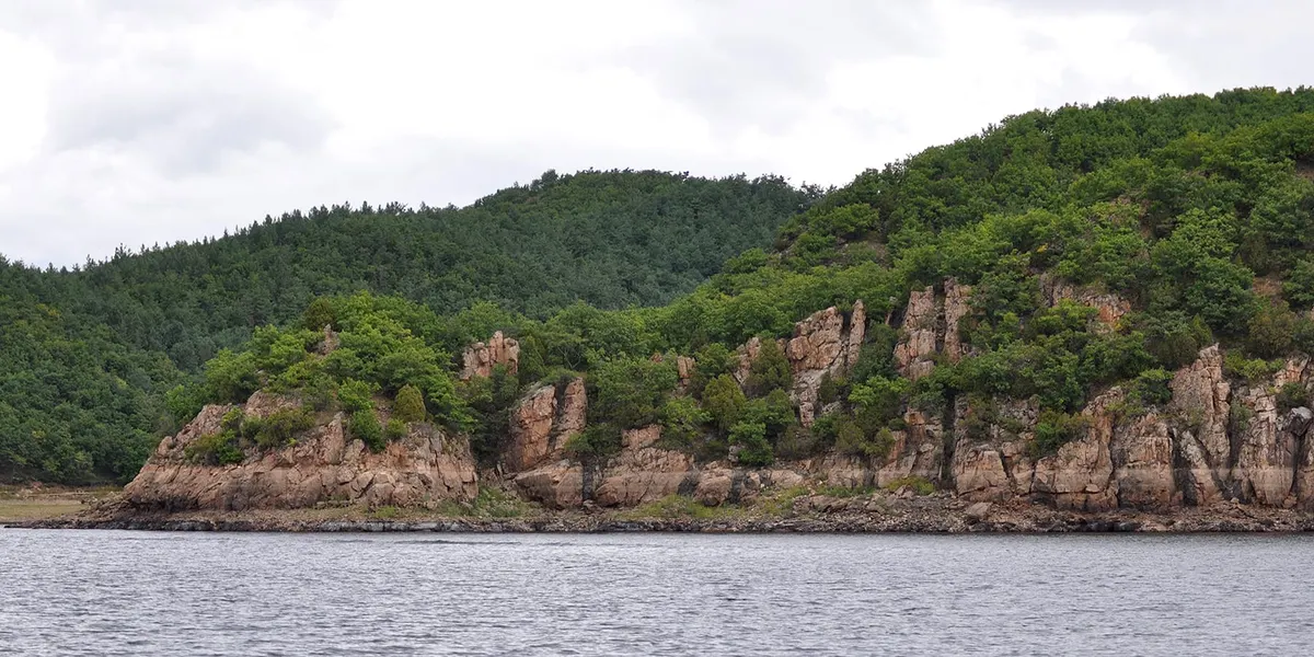
Jingpohu — Mirror Lake (镜泊湖, Jìngpō Hú)
The 45-kilometer-long alpine barrier lake formed by volcanic damming of the Mudan River roughly 10,000 years ago. The lake is surrounded by forested volcanic hills, with the water an extraordinary blue-green on clear days. Lake cruises (¥100-150 for 1-2 hour routes as of June 2026) depart from the main wharf and pass small islands, cliffs, and the lakeside villas used by Chinese political elites in the 1950s-60s. The lake's most photographed spot is the Mao Gong Mountain (毛公山) viewpoint, where a ridge profile is said to resemble Mao Zedong lying in state. ¥100 scenic area entry as of June 2026.
Wikimedia Commons · CC-BY-SA
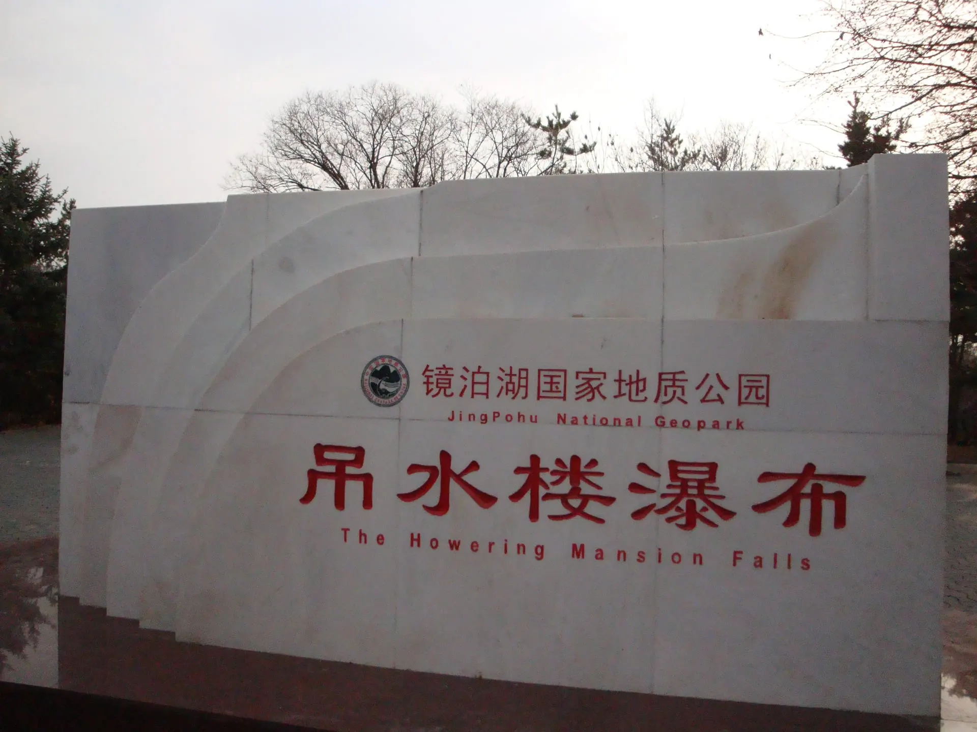
Diaoshuilou Waterfall (吊水楼瀑布, Diàoshuǐlóu Pùbù)
A 25-meter-high, 40-meter-wide waterfall where Jingpohu's outflow plunges over a black basalt cliff — one of the world's rare volcanic-rock waterfalls. In summer (June-September), the flow is at its strongest, and a local daredevil performer (the "waterfall diving man," 瀑布跳水人) does daily dives from the cliff edge (typically at 10:00 and 14:00). In winter, the waterfall freezes into a massive ice curtain, becoming a destination for ice climbers and photographers. Included in scenic area entry.
Wikimedia Commons · CC-BY-SA
Underground Forest — Crater Forest (地下森林, Dìxià Sēnlín)
A dense forest growing inside the 500-meter-wide, 130-meter-deep crater of an extinct volcano, about 50 km northwest of the main lake area. Visitors descend stone steps into the crater, walking among 500-year-old Korean pines, Manchurian ash, and rare ferns in a microclimate that is cooler and wetter than the surrounding plateau. The crater floor feels like a hidden world — the walls block the wind, the canopy filters the light, and the silence is broken only by birdsong. ¥60 as of June 2026. Allow 2-3 hours.
Wikimedia Commons · CC-BY-SA
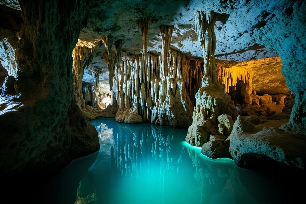
Jingpohu Karst Caves (镜泊湖熔岩洞, Jìngpō Hú Róngyán Dòng)
A network of lava tube caves in the volcanic rock near the lake, formed during the eruptions that created the lake basin. The main accessible cave is about 200 meters long, with lava stalactites, flow lines on the walls, and a constant cool temperature (about 5-8°C year-round). Smaller and less dramatic than the Crystal Palace at Wudalianchi, but geologically interesting and a welcome cool retreat on a hot summer day. ¥30 as of June 2026.
Wikimedia Commons · CC-BY-SA
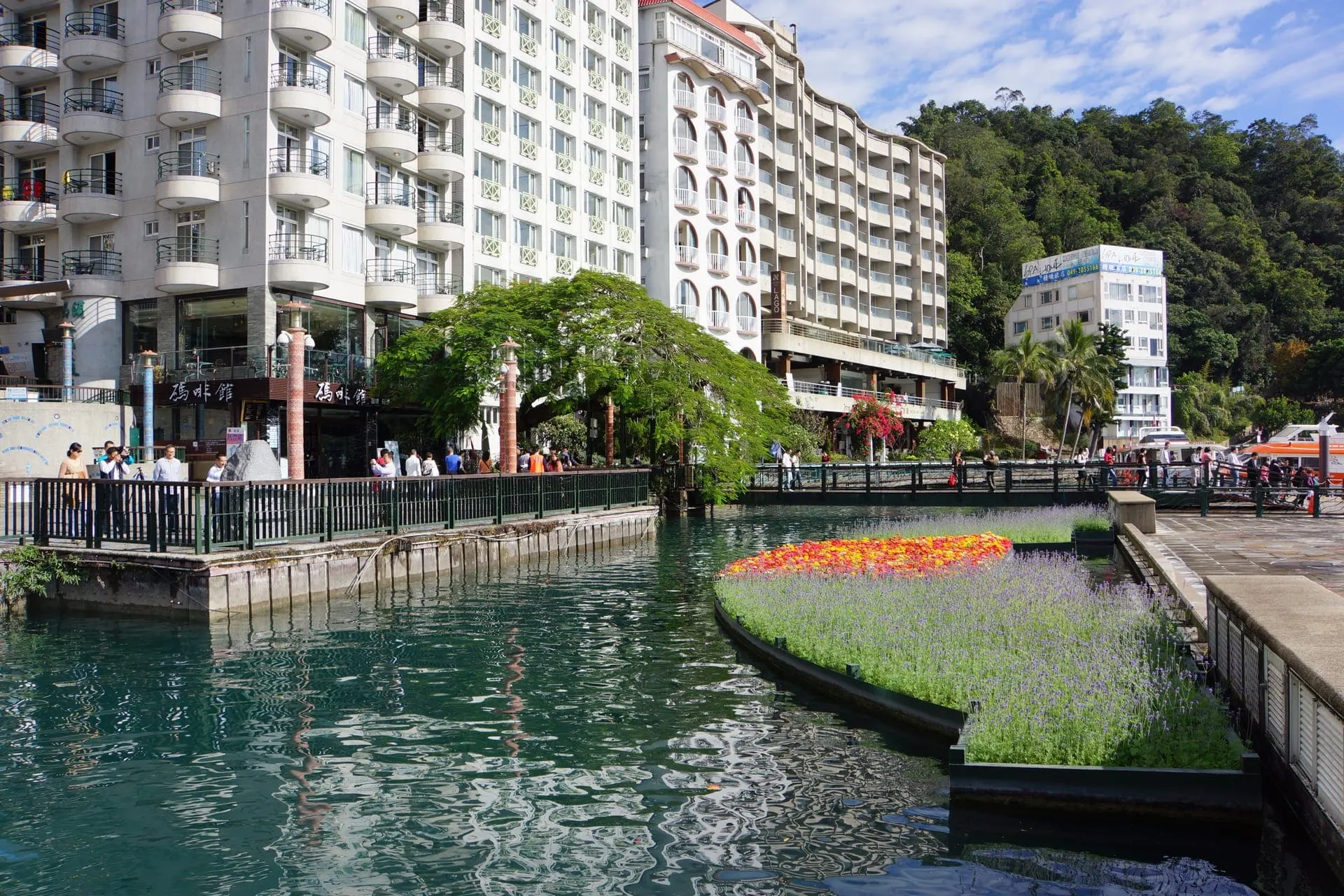
Wharf Area and Lake Cruises (镜泊湖码头, Jìngpō Hú Mǎtóu)
The main departure point for lake cruises, with several wharves serving different routes. The classic cruise (1.5-2 hours, ¥150) takes in the main lake scenery, passing islands, the Mao Gong Mountain viewpoint, and the lakeside forest. Shorter routes (1 hour, ¥100) cover the northern lake. Boats depart regularly in summer (roughly every 30-60 minutes from 08:00 to 16:00) but are suspended in winter when the lake freezes. The wharf area also has restaurants, snack stalls, and souvenir shops.
Wikimedia Commons · CC-BY-SA
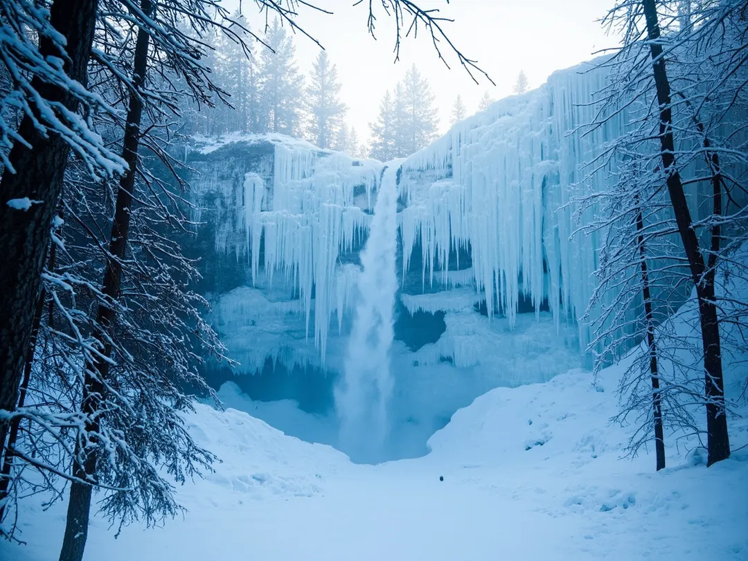
Diaoshuilou Ice Waterfall — Winter Only (吊水楼冰瀑, Diàoshuǐlóu Bīng Pù)
From December through February, the Diaoshuilou Waterfall freezes into a 40-meter-wide curtain of ice, with blue-white icicles hanging from the basalt cliff. The ice formation is illuminated at night during the Jingpohu Ice and Snow Festival (January-February), and the frozen lake hosts ice fishing, ice skating, and snowmobile rides. Ice climbers attempt the frozen waterfall during the festival. This is a completely different experience from the summer waterfall — stark, silent, and surreal. Included in winter scenic area entry (¥80 as of June 2026).
Wikimedia Commons · CC-BY-SA
Bohai Kingdom Ruins (渤海国上京龙泉府遗址, Bóhǎi Guó Shàngjīng Lóngquánfǔ Yízhǐ)
The ruins of Sanggyeong (上京, Shàngjīng), the capital of the Bohai Kingdom (698-926 AD), a medieval state that controlled much of Manchuria and the Russian Far East. The site, about 30 km from the lake, includes the foundations of palace halls, city walls, a Buddhist temple with a stone pagoda, and the Xinglong Temple (兴隆寺), which houses a 6-meter stone Buddha lamp from the Bohai period. The ruins are atmospheric but under-interpreted — signage is mostly Chinese, and the site is largely unrestored. ¥35 as of June 2026.
Wikimedia Commons · CC-BY-SA
STAY
Where to stay in Jingpohu
Pick a base that matches the trip you want — imperial-central for sightseeing, hutong belt for character, Chaoyang for nightlife, or Qianmen for budget.
Jingpohu Scenic Area (Lake & Waterfall)
The primary tourist zone — waterfall, wharf, lake cruises, hotels, and restaurants, all within a walkable 2 km radius
#jingpohu-scenic-areaUnderground Forest Area
Remote crater forest 50 km northwest of the lake — basic guesthouses, best visited as a day trip from the lake zone
#underground-forest-areaMudanjiang City (牡丹江市)
The regional hub 1.5 hours from Jingpohu — widest hotel and restaurant selection, best infrastructure, Korean-Chinese food scene
#mudanjiang-cityBohai Kingdom Ruins Area
Historical zone 30 km east of the lake — the medieval Bohai capital ruins, Xinglong Temple, and rural Heilongjiang villages
#bohai-ruins-area
ITINERARIES
Sample itineraries from Jingpohu
Three ready-made routes, from a 1-day imperial sprint to a 5-day deep dive. Copy the day-by-day plan and adapt to your own pace.
- 1 DAY
One-Day Jingpohu Sprint (from Mudanjiang)
Lake, waterfall, and lava caves in a single day. Misses the Underground Forest and Bohai ruins.
- Day-trippers from Mudanjiang
- Travelers with limited time
- Those wanting the lake and waterfall highlights
- Day 01
Morning
Depart Mudanjiang 07:00, arrive Jingpohu 08:30. Diaoshuilou Waterfall — viewing platforms, catch the 10:00 waterfall-diving performance (1.5 hours).
Afternoon
Lake cruise (1.5 hours, depart 11:00). Lunch at wharf restaurant — lake fish specialty. Lava tube caves (30 min). Lakeside trail walk to Mao Gong Mountain viewpoint (1 hour).
Evening
Return to Mudanjiang by 17:00. Korean-Chinese dinner in Mudanjiang — cold noodles and barbecue.
- 2 DAYS
Two-Day Classic Jingpohu
The recommended visit — lake, waterfall, Underground Forest, and the best light at sunrise and sunset.
- Most visitors
- Nature and geology enthusiasts
- Those wanting the complete Jingpohu experience
- Day 01
Morning
Arrive Jingpohu by late morning. Diaoshuilou Waterfall — catch the 14:00 dive performance, walk the viewing platforms (1.5 hours).
Afternoon
Lake cruise (1.5 hours, late afternoon for best light). Lava tube caves (30 min). Check into lakeside hotel.
Evening
Sunset walk along the lake shore. Dinner at a lakeside restaurant — braised lake fish. Early night for sunrise.
- Day 02
Morning
Sunrise at the lake (05:00-06:00 in summer). Drive to the Underground Forest (1 hour). Explore the crater forest — descend, walk, ascend (2-3 hours).
Afternoon
Drive back to the lake area for lunch. Optional: kayaking on the lake (1 hour, ¥80-120). Or visit the Bohai Kingdom ruins (2 hours round-trip).
Evening
Depart for Mudanjiang or Harbin by late afternoon. Arrive Mudanjiang by evening for Korean-Chinese dinner.
- 3 DAYS
Three-Day Comprehensive Jingpohu
The full experience — lake, waterfall, Underground Forest, Bohai ruins, and time to absorb the landscape.
- Slow travelers
- History and geology enthusiasts
- Photographers
- Day 01
Morning
Arrive Jingpohu, settle in. Late-morning waterfall visit — viewing platforms, 10:00 dive performance.
Afternoon
Lake cruise (1.5 hours). Lava tube caves. Lakeside trail walk. Check into lakeside hotel.
Evening
Sunset at the lake. Dinner: braised lake fish at a wharf restaurant. Evening walk along the shore.
- Day 02
Morning
Sunrise at the lake. Breakfast. Drive to the Underground Forest (1 hour). Full exploration of the crater forest (2-3 hours). Lunch near the Underground Forest or back at the lake.
Afternoon
Drive to the Bohai Kingdom ruins (1 hour from the lake). Explore the palace foundations, stone pagoda, and Xinglong Temple with the Buddha lamp (2 hours).
Evening
Return to the lake. Final sunset. Farewell dinner at the best lakeside restaurant.
- Day 03
Morning
Second waterfall visit — different light, quieter before day-trippers. Kayaking or SUP on the lake (1-2 hours). Relaxed lakeside walk.
Afternoon
Check out. Optional: visit the Jingpohu Geological Museum (near the visitor center, 30 min).
Evening
Depart for Mudanjiang or Harbin. Arrive evening.
BUDGET
What a Jingpohu trip costs
Per-person, per-day costs across three spending tiers. Excludes international flights and visa fees.
| Line item | Backpacker | Mid-range | Luxury |
|---|---|---|---|
| Jingpohu scenic area entry (lake + waterfall) | $14 | $14 | $14 |
| Underground Forest entry | $8 | $8 | $8 |
| Lake cruise (1.5-2 hours) | $14 | $21 | $21 |
| Private car and driver (per day) | $55 | $65 | $85 |
| Budget guesthouse (per night) | $20 | $0 | $0 |
| Mid-range hotel (per night) | $0 | $55 | $0 |
| Lakeside hotel (per night) | $0 | $0 | $100 |
| Lakeside restaurant meal (fish-focused) | $0 | $14 | $20 |
| Budget local restaurant meal | $5 | $0 | $0 |
| Miscellaneous (snacks, water, kayak rental) | $5 | $10 | $15 |
| Total per day | $121 | $187 | $263 |
$ USD per person per day, before international flights and visas. Last verified: Q3 2026.
STAY SAFE
Emergency contacts in Jingpohu
Save these three numbers before you board the plane. China uses different hotlines than most countries — there's no 911.
- POLICE
110
- AMBULANCE
120
- FIRE
119
- TOURIST HOTLINE
0453-6278012 (Jingpohu Scenic Area Administration)
- ENGLISH-SPEAKING ER
Mudanjiang First People's Hospital (牡丹江市第一人民医院) in Mudanjiang — 1.5 hours from Jingpohu; limited English-speaking staff
Problems travelers hit in Jingpohu
- Why is my Alipay not working?You linked a foreign Visa or Mastercard to Alipay but every transaction is rejected at the merchant.
- My China visa was denied — what now?Your L visa application was refused at the Chinese consulate and your trip is in 2–4 weeks.
- My passport was lost or stolen in China — what do I do?Your passport is gone (theft or loss) and you're in mainland China without travel documents.
- Why can't I book on 12306 with my foreign card?You tried to book a high-speed rail ticket on 12306.cn and your foreign Visa/Mastercard is rejected at checkout.
- Why is my VPN not working in China?You arrived in China, opened your VPN, and it will not connect at all or connects but no traffic loads.
- Why can't I book a Tibet trip on my own?You try to book Lhasa flights and hotels yourself but the booking fails, or you're turned away at the Lhasa airport without a permit.
Book activities in Jingpohu
These are licensed tour operators and booking platforms we've vetted independently. Booking through these links may earn us a commission — see our affiliate disclosure. This never affects our editorial recommendations or the price you pay.
Frequently asked questions
Is Jingpohu worth visiting?
How do I get to Jingpohu?
How many days do I need in Jingpohu?
What is the Underground Forest?
Does the Diaoshuilou Waterfall always have water?
Can I visit Jingpohu in winter?
Show all 20 FAQs
What is the best month to visit Jingpohu?
Do I need a car and driver for Jingpohu?
What is the waterfall-diving performer?
What are the Bohai Kingdom ruins?
Can I swim in Jingpohu?
Is Jingpohu suitable for children?
How is Jingpohu different from Wudalianchi?
Can I see the ice waterfall without visiting in deep winter?
What should I pack for Jingpohu?
How do I get from Mudanjiang or Harbin to Jingpohu?
What is the best season to visit Jingpohu?
Is Jingpohu suitable for a family trip with children?
How long should I plan for Jingpohu?
What local food should I try in Jingpohu?
References

Related guides & destinations
Guide
How We Research 2026: NihaoVisit’s Methodology for China Travel Information
How NihaoVisit sources, verifies, and maintains 700+ pages of China travel information — our source hierarchy, fact-checking process, update
Guide
Fact-Checking Log 2026: Verified China Travel Information — NihaoVisit
A public log of fact-checking verification passes on NihaoVisit, showing what was verified, when, and against which sources — covering visa
Guide
Best Time to Visit China 2026: Month-by-Month Weather, Crowds, and Prices
The best time to visit most of China is April–May and September–October. Winter (Dec–Feb) is cold but cheap; summer (Jun–Aug) is hot and cro
Guide
VPN for China 2026: Which VPNs Work, eSIM Alternatives, and the Complete Pre-Trip Checklist
Most Western apps and websites are blocked in mainland China. A reliable VPN is essential for Google, Gmail, WhatsApp, Instagram, and most n
Guide
China SIM Card and eSIM Guide 2026: Stay Connected Without WeChat
A Chinese SIM or eSIM lets you use mobile data, maps, and ride-hailing without WiFi. Here is how to get one, the cost, and which provider to
Guide
Solo Female Travel in China 2026: Safety, Tips, and Real Experiences
China is one of the safer destinations for solo female travelers. Petty theft is rare, violent crime against tourists is extremely uncommon,