Wudalianchi
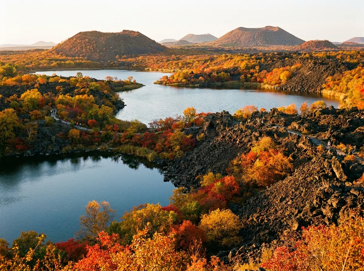
Wudalianchi (五大连池, Wǔdàliánchí) — the name means "Five Connected Lakes" — is a volcanic landscape in far northern Heilongjiang province, near the Russian border, that is unlike anything else in China. The lakes formed between 1719 and 1721, when the Laohei Mountain (老黑山, Lǎohēi Shān) and Huoshao Mountain (火烧山, Huǒshāo Shān) erupted — China's youngest volcanic eruption — and lava flows dammed the Bai River (白河), creating five interconnected lakes in a chain. The landscape that resulted is surreal: black basalt lava fields stretching for kilometers, 14 volcanic cones rising from the plain, the five blue-green lakes strung between them, and a network of natural mineral-water springs that have drawn people seeking cures for centuries. The volcanic geology here is remarkably well-preserved — you can still see lava tubes, ropey pahoehoe formations, and pressure ridges from the 1719 flow — and the site is a UNESCO Global Geopark since 2004. The mineral water is the other draw: Wudalianchi's cold carbonated springs are rich in iron, silica, and trace minerals, and the local tradition of "drinking the cure" (饮疗, yǐn liáo) and "bathing the cure" (浴疗, yù liáo) attracts thousands of Russian and Chinese visitors each summer. The honest downside: Wudalianchi is remote — 4-5 hours from Harbin by road — with limited infrastructure, basic accommodation, and almost no English spoken. It is not a comfortable destination. But if you want a genuinely strange, beautiful, and geologically fascinating landscape far from China's standard tourist circuit, it delivers.
Why Wudalianchi in 2026.
Five Connected Lakes born from China's youngest volcanic eruption, a landscape of black lava fields, mineral springs said to heal, and cold-water bathing in Heilongjiang's far north.
Quick Answer
Wudalianchi (五大连池, Wǔdàliánchí) — the name means "Five Connected Lakes" — is a volcanic landscape in far northern Heilongjiang province, near the Russian border, that is unlike anything else in China. The lakes formed between 1719 and 1721, when the Laohei Mountain (老黑山, Lǎohēi Shān) and Huoshao Mountain (火烧山, Huǒshāo Shān) erupted — China's youngest volcanic eruption — and lava flows dammed the Bai River (白河), creating five interconnected lakes in a chain. The landscape that resulted is surreal: black basalt lava fields stretching for kilometers, 14 volcanic cones rising from the plain, the five blue-green lakes strung between them, and a network of natural mineral-water springs that have drawn people seeking cures for centuries. The volcanic geology here is remarkably well-preserved — you can still see lava tubes, ropey pahoehoe formations, and pressure ridges from the 1719 flow — and the site is a UNESCO Global Geopark since 2004. The mineral water is the other draw: Wudalianchi's cold carbonated springs are rich in iron, silica, and trace minerals, and the local tradition of "drinking the cure" (饮疗, yǐn liáo) and "bathing the cure" (浴疗, yù liáo) attracts thousands of Russian and Chinese visitors each summer. The honest downside: Wudalianchi is remote — 4-5 hours from Harbin by road — with limited infrastructure, basic accommodation, and almost no English spoken. It is not a comfortable destination. But if you want a genuinely strange, beautiful, and geologically fascinating landscape far from China's standard tourist circuit, it delivers.
| Worth visiting | Yes, for geology enthusiasts and travelers who want a truly off-the-beaten-path Chinese landscape — but expect basic infrastructure and almost no English. |
|---|---|
| Recommended days | 2-3 days |
| Best time to visit | June-September (summer is brief in northern Heilongjiang; the mineral springs and bathing facilities only operate in warm months, roughly June through September) |
| Daily budget | $35 (backpacker) / $100 (mid-range) / $260+ (luxury) |
| Family friendly | Moderate — lava landscapes fascinate children, the lakes are calm, and the walking is easy. But facilities are basic and summer insects are intense. |
| Solo friendly | Challenging solo — transport connections are sparse, English is nonexistent, and the spread-out sites require a driver or tour. Best with a Chinese-speaking companion or tour. |
| Airport | Heihe Aihui Airport (HEK) — 2.5 hours by road from Wudalianchi. Harbin Taiping International Airport (HRB) is 4-5 hours by road or 5 hours by train + bus. |
| High-speed rail | No direct HSR. Nearest station is Harbin (4-5 hours by road). Wudalianchi Railway Station serves slow K-trains from Harbin (5-6 hours). Best option: HSR to Harbin, then bus or private car. |
| Language | Mandarin with heavy Northeastern dialect (东北话, Dōngběi huà); English is essentially nonexistent outside the geopark museum |
| Currency | CNY (¥) — Alipay and WeChat Pay accepted at the geopark ticket office and larger hotels; carry ¥500+ cash for mineral spring fees, small restaurants, and transport |
| Time zone | China Standard Time (UTC+8) |
| Last updated | 2026-06-18 |
Want a Wudalianchi plan built for you?
Jump to:
Laohei Mountain·Yaoquan Mountain·Mineral Springs·Crystal Palace·Longmen Stone Village·Getting Around·Where to Stay·Itineraries·Weather·Food·Tips & Warnings·The Five Lakes·Ethnic Minorities·Photography·Comparing Volcanic Sites·Local Products·Crystal Palace Cave·Combining with Heilongjiang·UNESCO Geopark·Emergency Contacts·FAQ
Why visit Wudalianchi? Is this remote volcanic landscape worth the trip?
Wudalianchi is not for everyone. It is remote — 4-5 hours from Harbin, the nearest major city — with basic accommodation, minimal English, and a spread-out landscape that requires a car and driver to navigate. The infrastructure is functional but unpolished: Soviet-era sanatoria sit next to modern geopark visitor centers, and the mineral-spring bathing facilities have a utilitarian, public-pool feel that might surprise visitors expecting a spa resort. But if you accept those caveats, Wudalianchi offers something genuinely rare: a young, well-preserved volcanic landscape with active mineral springs, set in the vast openness of far northern China. The lava fields of Laohei Mountain are less than 300 years old — in geological terms, brand new — and walking across the ropey pahoehoe flows, looking into the 145-meter-deep crater, and seeing how the eruption dammed a river to create five lakes is a direct encounter with planetary forces that feels immediate, not abstract. The mineral-water culture is the other layer. Wudalianchi's cold carbonated springs have attracted health-seekers for centuries, and the tradition — Russian and Chinese, medical and folk — of "taking the waters" here is still vibrantly alive. Seeing locals fill rows of plastic bottles at the spring taps, or bathers soaking in 4°C mineral water on a hot summer day, is a cultural experience as much as a geological one. Who should go: geology enthusiasts, landscape photographers, travelers who have seen China's greatest hits and want something completely different, and anyone with an interest in volcanic landscapes or mineral springs. Who should not go: travelers on a tight schedule, those who need comfort and polished infrastructure, and anyone who gets frustrated by language barriers. Wudalianchi rewards patience and curiosity; it punishes hurry.
What is the geological story of Wudalianchi: the 1719-1721 eruption?
Wudalianchi is part of the Wudalianchi Volcanic Field, a cluster of 14 volcanic cones spread across about 800 square kilometers in the Songnen Plain of northern Heilongjiang. The volcanism here is intraplate — not at a tectonic boundary, but fed by a mantle hotspot beneath the continental crust — and the eruptions have been intermittent over the past 2 million years. The most recent eruption, and the one that created the modern landscape, occurred between 1719 and 1721 during the Qing dynasty. Laohei Mountain (老黑山, 515.9m) and Huoshao Mountain (火烧山, 392m) erupted simultaneously, producing basaltic lava flows that advanced across the plain and blocked the Bai River (白河) in multiple places. The river backed up behind the lava dams, forming five interconnected lakes — the Five Connected Lakes (五大连池, Wǔdàliánchí) — that give the region its name. The eruption was witnessed and recorded in Qing-dynasty chronicles, which describe "fire and smoke rising from the ground, stones flying into the sky, and the Bai River blocked to form lakes." The lava from the 1719-1721 eruption is remarkably fresh. Walking on the Laohei Mountain lava field, you can see pahoehoe (ropey) lava surfaces, pressure ridges, collapse pits, and lava tubes exactly as they formed — there has been almost no erosion in 300 years. The crater of Laohei Mountain is 350 meters in diameter and 145 meters deep, with steep walls of scoria (volcanic cinder) and a flat floor. A walking path circles the rim, and the view from the top takes in the five lakes, the other volcanic cones, and the flat expanse of the Songnen Plain stretching to the horizon. The mineral springs are a product of the same volcanic system. Groundwater percolates through the volcanic rock, dissolving carbon dioxide from deep magmatic sources and picking up iron, silica, calcium, magnesium, and trace elements from the basalt. The water emerges cold (2-4°C), naturally carbonated, and mineral-rich, at dozens of spring outlets around the base of Yaoquan Mountain. The springs have been used for drinking and bathing for at least 200 years, and the local "cold mineral water therapy" tradition is recognized in China as a form of medical treatment for digestive, skin, and joint conditions.
How to get to Wudalianchi from Harbin and beyond?
Wudalianchi is remote by Chinese standards, and getting there requires planning. The nearest major city is Harbin (哈尔滨), about 350 kilometers to the south. By road from Harbin: The most common route. A private car or DiDi from Harbin takes 4-5 hours and costs ¥800-1,200 one-way. Buses run from Harbin South Bus Station (哈南客运站) to Wudalianchi town (五大连池市) 2-3 times daily, taking about 5-6 hours and costing ¥80-120. From Wudalianchi town, you need a local taxi or minibus to reach the geopark scenic area (about 20 km, 30 minutes, ¥30-50). By train: Wudalianchi Railway Station (五大连池站) is on the Harbin-Heihe conventional railway line, served by slow K-class trains from Harbin (5-6 hours, ¥50-70 hard seat, ¥100-140 hard sleeper). There is no high-speed rail to Wudalianchi as of June 2026. The station is in Wudalianchi town, about 20 km from the geopark scenic area — take a local taxi (¥30-50). By air: The nearest airport is Heihe Aihui Airport (HEK), about 160 km north of Wudalianchi (2-2.5 hours by road). Heihe has flights from Harbin (1 hour, from ¥400) and Beijing (2.5 hours, from ¥800). From Heihe, take a bus or hire a car to Wudalianchi. Practical recommendation: For most foreign travelers, the best approach is HSR to Harbin (from Beijing: 6 hours; from Shenyang: 2.5 hours; from Changchun: 1.5 hours), then hire a private car and driver for the 4-5 hour drive to Wudalianchi. This is the most expensive option but the most reliable — public buses from Harbin to Wudalianchi are infrequent, slow, and have no English signage. The car costs ¥800-1,200 each way and can be arranged through a Harbin hotel or a Chinese travel platform (Trip.com, Ctrip). The geopark scenic area is spread out — the main sites (Laohei Mountain, Yaoquan Mountain, the Crystal Palace, Longmen Stone Village) are 5-15 km apart — and there is no shuttle bus system connecting them. You need a car and driver, or you need to join a tour. A local driver for a full day costs ¥300-500. Some hotels can arrange this; otherwise, negotiate with a taxi driver at the geopark visitor center.
How to get around the Wudalianchi Geopark and what to know about logistics?
The Wudalianchi UNESCO Global Geopark covers about 800 square kilometers, and the main visitor sites are spread across a 15-kilometer radius. There is no internal shuttle bus network, no DiDi service, and no public transport connecting the sites. You have two options: hire a private car and driver for the day (¥300-500, arrange through your hotel or at the geopark visitor center), or join a Chinese-language tour group from Harbin (¥400-800 per person for a 2-day package, including transport and basic accommodation). The geopark entry ticket system as of June 2026: a comprehensive pass (¥240) covers Laohei Mountain, the Geological Museum, and the main scenic areas. Individual sites have separate entry fees: Yaoquan Mountain spring access (¥30), Crystal Palace ice cave (¥30), Longmen Stone Village (¥50), North Spring drinking (¥20) and bathing (¥60), South Spring bathing (¥60). A full visit covering all sites costs roughly ¥350-400 in entry fees. The geopark is open roughly 07:00-17:30 in summer (June-September) and 08:00-16:30 in winter. Many facilities — the mineral-water bathing pools, the boat rides on the lakes, and some of the smaller spring sites — close entirely from October through May due to the cold. Summer (June-September) is the only season when all sites are open. A practical tip: the Geological Museum should be your first stop. It provides the context you need to understand the lava formations, the eruption history, and the mineral-water system. The museum is near the geopark visitor center, has English labels, and takes about 1-1.5 hours. Visit it before Laohei Mountain — the lava field will make much more sense afterward. Mosquitoes and biting insects are intense in summer, especially near the lakes and in the forested areas around Yaoquan Mountain. Bring strong insect repellent (DEET 30%+), wear long sleeves and pants in the early morning and evening, and consider a head net for the worst areas. The insects are a serious nuisance and can genuinely affect your enjoyment of the landscape if you are unprepared.
Where to stay in Wudalianchi: sanatoria, guesthouses, and the town?
Accommodation in Wudalianchi is functional rather than luxurious, and the most interesting option — the sanatoria (疗养院, liáoyǎng yuàn) — are a window into a very specific Chinese-Russian therapeutic culture. The sanatoria are Soviet-era and post-Soviet institutions built around the mineral springs, offering basic rooms, mineral-water drinking and bathing on-site, and a regimen of "therapy" that includes cold-water soaks, mineral-water consumption schedules, and dietary guidance. The largest and most established is the Wudalianchi Workers' Sanatorium (五大连池工人疗养院), with rooms from ¥150-350 per night as of June 2026. The sanatoria are popular with Russian visitors from across the border (Blagoveshchensk is only 2.5 hours away) and Chinese retirees spending a few weeks "taking the cure." Staying in one is a unique cultural experience — expect utilitarian Soviet-era buildings, canteen-style meals, and an atmosphere that is part hospital, part resort, part time capsule. Wudalianchi town (五大连池市, about 20 km from the geopark) has standard Chinese business hotels (¥150-300 per night) including a Home Inn (如家) and a GreenTree Inn (格林豪泰). These are comfortable, predictable, and entirely charmless. They are the practical choice if the sanatoria feel too rough. The scenic area near the geopark visitor center has a few small hotels and guesthouses (¥100-250 per night) that are the most convenient base for exploring. The Wudalianchi Hot Spring Hotel (五大连池温泉酒店) offers slightly more upscale rooms (¥300-500) with geothermal hot-spring baths — a welcome contrast to the cold mineral springs. Neighborhoods: the geopark scenic area (most convenient, limited options), Wudalianchi town (wider choice, 30-minute drive to sites), and the sanatorium zone near Yaoquan Mountain (most atmospheric, most basic). For most visitors, the geopark scenic area is the best base.
What is the mineral-water culture: drinking cures, cold baths, and Russian connections?
The mineral-water tradition at Wudalianchi is unlike anything else in China. The water emerges from the volcanic rock at 2-4°C, naturally carbonated, and rich in iron, silica, calcium, magnesium, and dozens of trace elements. It tastes like cold, fizzy, metallic mineral water — an acquired taste, but not unpleasant — and the local belief in its therapeutic properties is deep and genuine. The "drinking cure" (饮疗, yǐn liáo) involves consuming specific amounts of mineral water at specific times of day, typically 200-300 ml on an empty stomach in the morning, repeated 2-3 times daily. Different springs have different mineral profiles and are believed to treat different conditions: the North Spring is higher in iron and is traditionally used for digestive and blood-related issues; the South Spring is higher in silica and is used for skin and joint conditions. The water is drunk directly from the spring taps, and locals and regular visitors fill rows of 5-liter plastic bottles to take home. The "bathing cure" (浴疗, yù liáo) involves soaking in cold mineral-water pools (2-8°C) for 15-20 minutes at a time. The cold water is intensely stimulating — the first 30 seconds are genuinely shocking — and the traditional practice is to soak, then rest in the sun for 30 minutes, then repeat. The bathing is believed to improve circulation, reduce inflammation, and benefit skin conditions. Separate male and female bathing pools are the norm, and swimwear is required. The Russian connection is significant. Wudalianchi is only about 200 km from the Russian border at Heihe-Blagoveshchensk, and Russian visitors have been coming to the sanatoria since the Soviet era. During the summer months, you will hear as much Russian as Chinese around the springs, and the sanatoria have Russian-speaking staff and bilingual signage. The cross-border mineral-water culture — Russians from the Far East, Chinese from across the northeast — gives Wudalianchi a distinctive atmosphere that is neither fully Chinese nor fully Russian, but a unique blend of both. A honest note: the therapeutic claims for the mineral water are based on tradition and anecdotal evidence, not rigorous clinical trials. The water is safe to drink (it is monitored for quality) and the cold baths are refreshing on a hot day, but approach the health claims with appropriate skepticism. The real value is the cultural experience — watching locals and Russian visitors engaged in a therapeutic ritual that has continued for generations.
What are 1-day, 2-day, and 3-day itineraries for Wudalianchi?
One-day sprint (tight but doable): Start at the Geological Museum at 08:00 (1 hour). Drive to Laohei Mountain, climb to the crater rim, and walk the lava field (2-3 hours). Lunch at a local restaurant near the geopark. Afternoon: Yaoquan Mountain mineral springs — drink from the North Spring, visit the South Spring, try a cold mineral-water bath if you are brave (2 hours). End with a quick visit to the Crystal Palace ice cave (30 minutes). This covers the essentials but feels rushed. Two-day plan (recommended): Day 1 — Geological Museum (1 hour), Laohei Mountain climb and lava field (2-3 hours), lunch, Yaoquan Mountain and the mineral springs (2 hours), Crystal Palace ice cave (30 minutes). Overnight at a sanatorium or geopark hotel. Day 2 — Morning at Longmen Stone Village (2 hours, best in early light when the black lava contrasts with the sky), then drive to one of the five lakes for a walk along the shore (the Third Lake, 三池, has the best views and boat rentals for ¥40-60 per hour). Afternoon: return to the springs for another round of mineral water, or visit the Fanhua Spring (翻花泉) if you want a quieter, less touristy spring experience. Depart by late afternoon. Three-day immersive plan: Day 1 and 2 as above. Day 3 — Morning: explore the less-visited volcanic cones. Huoshao Mountain (火烧山), the second cone from the 1719 eruption, has fewer visitors and a more rugged feel than Laohei. The Wohu Mountain (卧虎山, "Crouching Tiger Mountain") is an older cone with forest growing in its crater — a beautiful contrast to the barren lava of Laohei. Afternoon: return to your favorite spring for a final soak, visit the Wudalianchi town market for local products (mineral water, volcanic mud skincare products, local honey), and depart. The third day adds depth — the smaller volcanic sites and the time to absorb the landscape — that makes the long journey to Wudalianchi feel more earned.
What is the weather and the best time to visit Wudalianchi?
Wudalianchi has a humid continental climate with long, harsh winters and short, warm summers. The visiting season is brief — roughly June through September — because the mineral-spring bathing facilities, boat rentals, and many restaurants and guesthouses close from October through May. January: -28 to -15°C. Brutally cold. The lava landscape under snow is beautiful in photographs, but the geothermal park is largely closed. Average 4 snowy days. February: -24 to -10°C. Still deep winter. Snow scenery continues. The Ice and Snow Festival in Harbin (January-February) can be combined with a winter visit to Wudalianchi for the snow-covered volcanoes, but most facilities are closed. Average 3 snowy days. March: -12 to 2°C. Thaw begins. Muddy, grey, and transitional. Not a good month to visit. Average 4 precipitation days. April: 0-13°C. Spring arrives slowly. The first green appears. The lakes thaw. Facilities remain closed. Average 6 rainy days. May: 7-21°C. The landscape greens up. Wildflowers appear on the lava fields. Some facilities begin to open in late May. The first comfortable month. Average 8 rainy days. June: 14-26°C. Summer begins. All facilities are open. The lakes are warm enough for boating. Mineral-water bathing is at its peak. The landscape is lush and green — a dramatic contrast with the black lava. Mosquitoes become intense. Average 12 rainy days. July: 18-28°C. Peak summer, peak visiting season. Warm days, cool nights. All facilities fully operational. The sanatoria are at their busiest with Russian and Chinese visitors. Mosquitoes are at their worst — bring DEET. Average 14 rainy days. August: 17-27°C. Still peak summer, gradually cooling toward month-end. The best balance of warm weather and manageable crowds. The lava fields in late-afternoon light are beautiful. Average 12 rainy days. September: 9-20°C. Early autumn. The best month for landscape — birch leaves turn gold, the light is clear and angled, and the black lava against autumn colors is spectacular. The mineral-spring bathing facilities close in mid-to-late September. Average 8 rainy days. October: 0-12°C. Late autumn. Beautiful colors through mid-month, then the leaves fall and temperatures drop. Most facilities close by early October. Average 5 rainy days. November: -12 to 0°C. Winter arrives. Snow begins. The landscape empties. All tourist facilities are closed. Average 4 snowy days. December: -24 to -12°C. Deep winter. The lava landscape under snow and ice has a stark beauty, but you will be almost entirely alone and facilities are closed. Average 4 snowy days.
What to eat in Wudalianchi: Northeast Chinese food and mineral-water specialties?
The food in Wudalianchi is classic Dongbei (东北, Northeast Chinese) cuisine — hearty, meat-focused, and designed for cold climates — with a few local specialties tied to the mineral water and the lakes. Mineral-water tofu (矿泉水豆腐, kuàngquánshuǐ dòufu) is the local signature dish. The tofu is made using the mineral spring water instead of regular water, which supposedly gives it a finer texture and a subtle mineral taste. It is typically served braised (红烧, hóngshāo) or in a clay pot (砂锅, shāguō) with mushrooms and vegetables. ¥25-40 per dish at local restaurants. Lake fish (湖鱼, hú yú) from the five interconnected lakes is the other local specialty — mostly carp, crucian carp, and catfish, typically braised in soy sauce with ginger and scallion (红烧鱼, hóngshāo yú) or cooked in a sour-cabbage stew (酸菜鱼, suāncài yú). ¥40-80 per dish depending on the fish and the restaurant. Standard Dongbei dishes fill out the menus: guo bao rou (锅包肉, crispy sweet-and-sour pork, ¥35-50), di san xian (地三鲜, stir-fried potato, eggplant, and green pepper, ¥25-35), dumplings (饺子, jiǎozi, ¥20-35 for a plate of 15), and the ubiquitous Dongbei-style barbecue (烧烤, shāokǎo) at outdoor grills in summer. For vegetarians: Dongbei cuisine is challenging — lard and meat stock are used extensively, and vegetable dishes often contain small amounts of minced pork. The phrases "wǒ chī sù" (我吃素, I eat vegetarian) and "bùyào ròu" (不要肉, no meat) are essential. Mineral-water tofu, di san xian (confirm no meat), and simple vegetable stir-fries are the safest options. Restaurants are concentrated in Wudalianchi town (wider selection, lower prices) and in the geopark scenic area (convenient, more expensive, variable quality). The sanatoria have their own canteens serving simple, institutional Chinese food (¥20-40 per meal) to guests.
What practical tips and warnings should I know for Wudalianchi?
1. YOU NEED A CAR AND DRIVER. The geopark sites are spread across a 15-kilometer radius with no shuttle buses, no DiDi, and no public transport. Arrange a driver through your hotel (¥300-500 per day) or join a tour. Do not attempt to visit Wudalianchi without transport. 2. ENGLISH IS ESSENTIALLY NONEXISTENT. The Geological Museum has English labels. Nothing else does. Restaurant menus, road signs, spring-facility instructions, and hotel front-desk communication are Chinese-only (and sometimes Russian). A translation app (Pleco, Baidu Translate) and pre-saved Chinese-character names for your destinations are essential. 3. THE VISITING SEASON IS SHORT. The mineral-spring bathing pools, boat rentals, and many guesthouses operate only from June through September. Outside this window, the landscape is still there and is beautiful under snow, but the infrastructure closes down and the experience is fundamentally different — you are alone in a closed geopark, which has its own appeal but requires self-sufficiency. 4. MOSQUITOES ARE BRUTAL IN SUMMER. Wudalianchi has wetlands, lakes, and forests — perfect mosquito habitat. From June through August, the insects are intense, especially near the lakes and in the Yaoquan Mountain spring area. Bring DEET 30%+ insect repellent, wear long sleeves and pants at dawn and dusk, and consider a head net for the worst areas. This is not an exaggeration — the mosquitoes can genuinely ruin an afternoon if you are unprepared. 5. THE MINERAL WATER IS AN ACQUIRED TASTE. It is cold, fizzy, and tastes strongly of iron and minerals. Many visitors find it unpleasant on first sip. If you want to try it, start with a small cup (¥2-5 at the spring taps) rather than filling a bottle. 6. THE COLD BATHS ARE GENUINELY COLD. The mineral-water bathing pools are 2-8°C — cold enough to take your breath away. The first 30 seconds are a shock. If you have heart or circulatory conditions, skip the cold bath. If you are healthy, it is a bracing experience — but 10-15 minutes is plenty. 7. ACCOMMODATION IS BASIC. Even the best hotels in Wudalianchi are 3-star equivalent at most. The sanatoria are Soviet-era institutional buildings with hard beds, erratic hot water, and canteen food. Adjust expectations accordingly — this is not a comfort destination. 8. BRING CASH. Many smaller sites, spring-facility ticket booths, and local restaurants do not accept mobile payment (Alipay/WeChat Pay). Carry ¥500-800 in cash for entry fees, springs, and meals. 9. THE HEIHE-RUSSIAN BORDER IS 2.5 HOURS AWAY. Heihe (黑河) on the Chinese side faces Blagoveshchensk on the Russian side across the Amur River (Heilongjiang). The border crossing is open to Russian and Chinese citizens; for most other nationalities, a Russian visa is required. The Heihe-Blagoveshchensk connection explains the strong Russian presence in Wudalianchi's sanatoria. 10. COMBINE WITH HARBIN FOR A NORTHEAST ITINERARY. Wudalianchi works best as part of a larger Heilongjiang trip: 2-3 days in Harbin (Russian architecture, ice festival in winter, Dongbei food) + 2-3 days in Wudalianchi (volcanoes, mineral springs). The 4-5 hour drive between them is through the vast, flat Songnen Plain — one of China's major agricultural regions — and the landscape of endless corn and sunflower fields has its own austere beauty.
What are the five connected lakes and how do they fit into the landscape?
The five lakes are the namesake of the whole region — 五大连池 literally means "Five Connected Lakes" — and they are the visual and ecological heart of the geopark. After the 1719-1721 eruption, lava from Laohei Mountain and Huoshao Mountain flowed east and dammed the Bai River (白河) in multiple places. The river backed up behind these lava dams and formed a chain of five lakes, numbered one through five (from north to south) and connected to each other by the residual flow of the river. They are not five separate lakes in the ordinary sense — they are one river system interrupted by volcanic dams, and the water level, color, and ecology shift gradually from one to the next. The lakes differ noticeably from each other. The First Lake (一池) and Second Lake (二池), at the northern end of the chain, are smaller, shallower, and surrounded by birch forest and lava fields — quieter and more intimate. The Third Lake (三池) is the largest and the most visited. It has the deepest blue-green color, calm water, and is the only lake where boat rentals are widely available in summer (rowboats and pedal boats, ¥40-60 per hour). The Fourth Lake (四池) and Fifth Lake (五池), at the southern end, are narrower and more marsh-fringed, with more waterfowl and a wilder, less developed feel. Walking the shoreline of any of the lakes takes you through a transition zone where black lava gives way to reeds, then to shallow water, then to the dark mirror of the lake surface — a striking visual sequence. Boating is the highlight of a lakeside visit. Pedal boats and rowboats on the Third Lake (三池) let you cross the water at your own pace, looking back at the volcanic cones lining the shore. In summer, the lake is calm enough that even inexperienced rowers can manage, and the reflections of the cones in the water are genuinely beautiful in early morning or late afternoon. Swimming is not permitted in the protected lakes — they are a national geopark, and some feed local water systems. Fishing is also restricted. The lakes are best enjoyed from the shore, from a boat, or from the elevated viewpoints on the rim of Laohei Mountain and Huoshao Mountain, where the entire chain is laid out below you like a string of dark mirrors on a black plain. Ecologically, the lakes are part of a wetland complex that supports migratory birds, waterfowl, and fish populations typical of the cold-temperate northeast. The cold winters freeze the lakes solid, and local folklore holds that the spring thaw — when the ice cracks and shifts with a sound like distant thunder — is one of the region's most dramatic natural events. In summer, the lakes attract herons, wild ducks, and the occasional otter, and the reed margins are thick with birdlife. If you are a quiet walker, the lake shorelines at dawn are the best time to see wildlife — and the best time to see the volcanic landscape without other visitors in the frame. A practical note: the lakes are not the main draw at Wudalianchi. The volcanic landscape is. But skipping the lakes entirely means missing a key piece of the story — they are the reason the place is called what it is, and they are the most peaceful part of a visit dominated by black rock and cold mineral water. Plan at least half a day for a lakeside walk or a boat ride, and you will leave with a much more complete picture of how fire and water together shaped this strange corner of Heilongjiang.
What ethnic minorities and regional culture will I encounter at Wudalianchi?
Wudalianchi sits in a part of Heilongjiang with a layered ethnic history. The region is Han Chinese in the majority today, but the broader northeast is homeland to several distinct minority groups, and the cultural texture of the area is shaped by that history. The main minority communities in the greater Wudalianchi area are the Manchu (满族), the Daur (达斡尔族), the Mongol (蒙古族), and the Hezhen (赫哲族) — each with their own language, dress, food traditions, and folklore. The Hezhen in particular are a small, historically fish-based culture of the Amur and Songhua river systems, and villages around Heilongjiang's far north preserve elements of that heritage. In daily life around the geopark, you will not see many obvious markers of minority culture — the towns look like standard northeast Chinese towns, and the geopark signage is in Chinese, Russian, and occasionally English rather than in minority scripts. But the food, the festival calendar, and some of the folk traditions around the mineral springs have roots in Manchu and Daur practices, and the small ethnographic sections in the regional museums (and, when available, the Wudalianchi town cultural center) put these in context. Manchu influence is the most visible: dumpling traditions (the Manchu origin of the jiaozi, later adopted across China), cold-water bathing rituals, and the broader northeast habit of preserving food through harsh winters all have Manchu roots. The Daur are the most distinctive minority historically associated with the Wudalianchi region. The Daur homeland (达斡尔族) straddles the Nen River and the upper Heilongjiang, and Daur villages around Morin Dawa Daur Autonomous Banner and the broader Heihe prefecture have preserved a distinct identity. The Daur language is part of the Mongolic family, but the Daur have their own traditional costume, their own festival calendar, and a historical reputation as horsemen, fishermen, and birch-bark crafters. Travelers with a specific interest in Daur culture would need to travel beyond the geopark to Morin Dawa (about 200 km west) to see the most authentic expressions, but the Wudalianchi town market occasionally has Daur birch-bark items and smoked fish that hint at the broader culture. The Mongol influence in the area is older and more diffuse — the Mongol Yuan dynasty and later periods left a legacy of grassland and steppe adaptation in northeast China, and the region's love of lamb, dairy, and hearty meat dishes owes something to that heritage. The Hezhen (also called Nanai in Russian) are the most localized of the minorities, historically a fishing culture of the lower Amur and Songhua. Their numbers are small, and their traditional villages are far to the east of Wudalianchi, but the smoked fish (烤鱼, kǎo yú) sold in regional markets — a Hezhen specialty — is worth trying if you encounter it. For most foreign visitors, the cultural experience at Wudalianchi is less about formal minority tourism and more about absorbing the regional atmosphere: a far-northeast Chinese town with Russian as a common second language, cold winters and warm-hearted people, and a strong food culture built around hard work, communal meals, and making the most of long, dark winters. Learning a few words of Dongbei hua (Northeastern Chinese dialect — direct, warm, fast, and full of jokes) will get you further than standard Mandarin, and the people in and around the geopark tend to be curious and welcoming toward foreign visitors who make even a small effort to engage.
What should a landscape photographer know about Wudalianchi?
Wudalianchi is a genuinely rewarding landscape photography destination — and a genuinely difficult one. The black lava and pale birch make for high-contrast scenes that are unforgiving of bad exposure, and the scale of the volcanic field is large enough that most wide-angle lenses struggle to capture it. The light, the weather, and the season matter more than equipment, and the best shots are usually taken by photographers who plan around the constraints of the place rather than fighting them. The first thing to know is the color palette. The landscape is essentially two-tone: black basalt and the greens and golds of birch, larch, and pine. When the birch leaves turn gold in late September and early October, the contrast with the black lava is at its peak — and the few photographers who make the trip in autumn often come back with the most striking images. In summer, the green of the trees softens the contrast; in winter, the snow does the same. The most dramatic light comes at sunrise and sunset, when the low angle picks out the ropey texture of the pahoehoe lava and turns the cones into sharp silhouettes. Midday light flattens everything and is best avoided for serious work. The second thing to know is the weather. The northeast is unpredictable, and a clear morning can turn into a thunderstorm by afternoon. The most useful kit items are: a polarizing filter (cuts glare on the lava, deepens the lake water), a graduated ND filter (the bright sky against the dark rock is a constant exposure problem), rain covers, and a tripod sturdy enough for the wind that comes up on the crater rim. Drone use is restricted in the geopark — you need to check with the scenic area administration, and the airspace around the protected lakes and springs is generally off-limits. Hand-held work is fine on the lava field (the light is usually bright enough), but the crater rim and the lake shorelines reward longer exposures. The third thing to know is the geology. The lava field at the base of Laohei Mountain is the centerpiece — pahoehoe (ropey) lava, pressure ridges, collapse pits, and the entrances to lava tubes. Walk the field with a guidebook or the Geological Museum in mind, and you will start to see the difference between a pressure ridge (a long, blade-like wall of lava that pushed up as the flow cooled) and a collapse pit (a circular depression where the roof of a lava tube fell in). Close-up shots of these features — at the level of the ropey surface, not the wide-angle view — are often more striking than the panoramic ones, because they show the texture and the mechanism of the flow. The fourth thing is timing. Early morning (5:30-7:30) and late afternoon (16:30-19:00, longer in midsummer) are the best windows. The crater rim of Laohei Mountain is at its most beautiful in the first hour after sunrise, when the mist from the mineral springs hangs over the lower ground and the cones emerge from it. The lake shorelines — especially the Third Lake (三池) — reward dawn visits for the reflections. The Yaoquan Mountain spring zone is most photogenic in late afternoon, when the low sun catches the mineral water and bathers at the cold pools. A final note on ethics. The lava field is a protected geological feature. Walking off the marked boardwalks damages fragile surface features that took 300 years to form and take only seconds to break. The boardwalks are placed where they are for a reason. Stay on them, and your images will still capture the landscape — the ropey lava, the pressure ridges, the cones — without contributing to its slow destruction. The geopark is a UNESCO Global Geopark, and the protection of its geological heritage is the reason it earned that designation.
How does Wudalianchi compare with Changbaishan and Tengchong, China’s other famous volcanic sites?
China is not commonly thought of as a volcanic country, but it has three genuinely famous volcanic landscapes: Wudalianchi in Heilongjiang, Changbaishan (长白山) on the North Korea border, and Tengchong (腾冲) in Yunnan. Each is fundamentally different in scale, climate, and the kind of experience it offers. Choosing among them is less about which is "best" and more about what kind of volcanic landscape and what kind of travel you are looking for. Changbaishan is the largest and most famous. It is a single massive stratovolcano — the highest peak in northeast China and on the Korean peninsula — with a deep crater lake (Tianchi, 天池) at its summit. The climb to the rim is dramatic, the lake is famously beautiful (when the weather cooperates, which is about half the time), and the surrounding forest reserve is one of the most biodiverse in the country. Changbaishan is also the most developed of the three: full-service resort hotels, cable cars, organized tour groups, and infrastructure for mass tourism. The cost is the crowds and the price tag. It is essentially a national-park experience at scale. Tengchong, in far western Yunnan near the Myanmar border, is the hot-spring and dormant-volcano experience. The volcanic cones at Tengchong (including Dakong Mountain and Xiaokong Mountain) are dormant — no eruption in recorded history — and the surrounding landscape is defined by geothermal activity: hot springs, fumaroles, steam vents, and the Rehai (热海, "Hot Sea") geothermal field, where water boils out of the ground. Tengchong has been a destination for Chinese visitors seeking hot-spring therapy for centuries, and the surrounding towns have hot-spring hotels, baths, and spa resorts at every price point. The climate is mild — subtropical Yunnan — and the food is some of the best in China. Wudalianchi is the youngest and most active-feeling of the three. The 1719-1721 eruption is the most recent volcanic eruption on the Chinese mainland, and the resulting landscape — fresh lava, intact craters, active mineral springs — feels immediate in a way that Changbaishan and Tengchong do not. Wudalianchi's defining feature is the combination: a young volcanic landscape with cold carbonated mineral springs used for drinking and bathing. No other Chinese volcanic site has this exact combination. Wudalianchi is also the smallest, the most remote, and the most basic in infrastructure. The honest comparison: choose Changbaishan for scale, drama, biodiversity, and a full national-park experience. Choose Tengchong for hot springs, mild climate, food, and a more relaxed atmosphere. Choose Wudalianchi for young volcanic geology, mineral-water culture, and the sense of a place that is not on the standard tourist circuit. The three are not interchangeable, and the dedicated traveler with time could see all three on a long China trip — but most visitors will only see one, and the choice should be driven by the kind of experience you want. A practical note for foreign travelers: Changbaishan is the most accessible (multiple direct flights, well-developed tourism infrastructure, English signage at major sites), Tengchong is in the middle (some English support, good hotels, but a long drive from Kunming), and Wudalianchi is the most challenging (limited English, basic infrastructure, requires a driver and patience). Wudalianchi is the highest-effort destination of the three. It is also, for the right traveler, the most rewarding — the most unusual, the most geological, and the most unlike anywhere else in China.
What local products, souvenirs, and mineral water can I bring home from Wudalianchi?
Wudalianchi's souvenir scene is small but distinctive, and the products reflect the same volcanic and mineral-water theme that defines the landscape. Most visitors come home with three things: bottled mineral water, volcanic-mud skincare products, and local honey. A few pick up smoked fish from the lakes, birch-bark crafts, or bottles of the local baijiu (白酒, Chinese liquor). The quality varies, and the marketing is often more enthusiastic than the science, but the products are genuinely tied to the place and make for unusual souvenirs. Bottled mineral water is the most obvious purchase. The Wudalianchi mineral water is commercially bottled by several local brands (五大连池 is a recognized矿泉水, kuàngquánshuǐ, or mineral water, designation in China) and is sold throughout the northeast. You can buy it cheaply at the geopark, at any supermarket in Wudalianchi town, and at the airport shops. The bottled version is the same water you can drink from the spring taps, with the same iron-and-silica taste. It travels well, and many visitors report that they enjoy the taste more after the trip than they did at the spring. Prices range from ¥3-5 for a small bottle to ¥30-50 for a case. Volcanic-mud skincare products are the other signature souvenir. The volcanic mud from Wudalianchi is marketed for its mineral content and supposed skincare benefits, and a small industry has built up around mud masks, mud soaps, and mud-based creams. The Wudalianchi town market and the geopark visitor center sell these in small gift packages (¥30-100). Whether the skincare claims are scientifically supported is debatable — the same skepticism that applies to the drinking-water health claims applies here — but the products are local, distinctive, and make for an unusual gift. Test a small amount on your skin before committing, as the mineral content can be irritating for sensitive skin. Local honey (蜂蜜, fēngmì) is a less obvious but very high-quality purchase. The linden (椴树, duànshù) forests of the greater Heilongjiang region produce a famous white honey — 椴树蜜, duànshù mì — that is mild, slightly minty, and crystallizes to a fine, almost fondant-like texture. It is sold in jars and squeeze bottles at most Wudalianchi shops and at the town market. ¥30-80 for a typical jar, depending on size. Genuine linden honey is one of the best regional food products in China, and a jar makes a useful and unusual souvenir. Smoked fish (熏鱼, xūn yú) from the lakes is sold at the town market and at some of the local restaurants. Carp and crucian carp from the Five Connected Lakes are brined and cold-smoked in traditional style, producing a firm, oily, intensely flavored fish that keeps for weeks unrefrigerated. The quality is variable — some of the smoked fish sold at the market is excellent, some is over-smoked and over-salted. ¥30-60 for a typical portion. Smoked fish is heavy and smelly in luggage, so consider this a gift for yourself at a hotel rather than a suitcase souvenir. A few smaller items worth knowing about: birch-bark crafts (桦树皮, huà shù pí) — small boxes, picture frames, and decorative items made from sheets of birch bark. These are made by Daur and Hezhen craftspeople in the region and are sold at the town market. They are light, durable, and visually striking. Volcanic rock samples (volcanic cinder, basalt pieces) are sometimes sold in small bags as geological souvenirs. The geopark visitor center also sells postcards, posters, and small books about the geopark in Chinese and English. And finally, a small bottle of the local baijiu (白酒) — clear, strong, sorghum-based liquor in the northeast tradition — is a classic Chinese regional product, and a bottle from Heilongjiang makes a good conversation piece at home. A practical note on export and customs. Mineral water, honey, and skincare products are fine to bring home in luggage. Smoked fish and meat products can be flagged by customs in some countries — check your home country's import rules before flying. Volcanic rock samples are allowed in most cases but check the airline's baggage rules. Liquid restrictions apply for carry-on: pack the mineral water, baijiu, and any liquid souvenirs in checked luggage.
What is the Crystal Palace ice cave and why does it stay frozen in summer?
The Crystal Palace (水晶宫, Shuǐjīng Gōng) — also called the Ice Cave (冰洞, Bīng Dòng) — is one of the most surreal experiences in the geopark. It is a lava tube cave that stays below freezing year-round, even when the outside temperature is 30°C in midsummer. Stepping from the August heat into a cave interior of -5 to -12°C is one of those few travel experiences that genuinely earns the word "surreal." The cave is part of the lava system that flowed from Laohei Mountain during the 1719 eruption. The outer surface of the lava flow cooled and crusted over while molten lava continued to flow inside, leaving hollow tubes — lava tubes — when the eruption stopped and the molten rock drained out. Most lava tubes at Wudalianchi have collapsed or been filled with sediment over the past 300 years, but the Crystal Palace tube is intact, large enough to walk through, and — most unusually — cold. Lava tubes in most parts of the world equilibrate to the mean annual air temperature within a few years. The Crystal Palace is different because of its geometry: the entrance is small and sloped upward into the cave, and the cave's interior shape traps cold winter air that sinks in from the entrance and pools inside. In the warm season, the cold air is too dense to escape back out the narrow entrance, so the cave stays cold. This is a natural cold trap, and the same effect keeps winter ice in some ice caves in Iceland, the Pacific Northwest, and the Alps frozen through the summer. The result, for visitors, is a lava tube lined with permanent ice. Ice crystals coat the walls and ceiling, stalactites of ice hang down where water has dripped and frozen, and the floor is a smooth, polished sheet of ice. The cave is artificially lit and has a boardwalk, so you walk safely above the ice and can see the formations clearly. The contrast is striking: you walk down steps from summer heat, through a door, and into a frozen world — the air hits you immediately, your breath turns to vapor, and any metal on your clothing or camera instantly frosts over. After 10-15 minutes inside, most visitors are ready to climb back out into the warmth. Practical details: the Crystal Palace costs ¥30 as of June 2026 and is part of the standard geopark tour. Bring a jacket even in summer — the temperature shock is dramatic and a T-shirt will not be enough. The boardwalk can be slippery from condensation, so wear shoes with reasonable grip. The cave is small — the visit takes about 20-30 minutes, and the path is one-way. Photography is allowed but tricky: the lighting is dim and the contrast between bright artificial lights and dark ice is hard for cameras to handle. A small tripod or a high-ISO setting helps. The Crystal Palace is sometimes skipped by visitors in a hurry, and that is a mistake. It is one of only a few places in the world where you can stand in a young volcanic tube and see ice in the middle of summer, and the experience is unique in China. Combined with the lava field above and the crater rim of Laohei Mountain, it completes the picture of what the 1719 eruption left behind: rock, fire, and — surprisingly — a small pocket of permanent winter.
How should I combine Wudalianchi with other destinations in Heilongjiang?
Wudalianchi works best as part of a broader Heilongjiang trip, and the most rewarding combinations are with Harbin (4-5 hours south by road), Heihe (2-2.5 hours north, on the Russian border), and — for the patient traveler — the broader north loop that includes the Daur heartland around Morin Dawa and the grassland steppe of the western Songnen Plain. None of these are short trips, and the time investment is significant. But the combinations turn a remote volcanic detour into a coherent and rewarding visit to one of China's most distinctive regions. The Harbin + Wudalianchi combination is the most common. Harbin is the largest city in the northeast outside of the coast — a Russian-influenced architectural and culinary city of about 10 million people, famous for its Ice and Snow Festival in winter and for Central Street (中央大街, Zhōngyāng Dàjiē) and the Saint Sophia Cathedral year-round. Two to three days in Harbin gives you enough time for the Ice Festival (January-February only) or, in summer, for a Russian-dinner evening, a stroll down Central Street, a visit to the Volga Manor or Sun Island, and an introduction to Dongbei cuisine. From Harbin, it is a 4-5 hour drive north to Wudalianchi — most visitors arrange a private car and driver, stay 2-3 days at the geopark, and drive back. The total trip is 5-7 days and is a satisfying introduction to the far northeast of China. The Heihe + Wudalianchi combination is the border-country option. Heihe (黑河) is the Chinese city that faces Blagoveshchensk across the Amur River (Heilongjiang, 黑龙江), and the two cities are linked by regular cross-border trade and tourism. Heihe is a small city by Chinese standards (around 1 million in the broader prefecture) with a frontier-town atmosphere, Russian signage and cuisine, and a winter that makes Wudalianchi feel mild. From Heihe, it is a 2-2.5 hour drive south to Wudalianchi. Most foreign travelers cannot cross the border into Russia without a Russian visa, but the Heihe side is itself an experience: the riverfront views of Blagoveshchensk, the Russian-style buildings, the Russian restaurants, and the cross-border market. A Harbin → Heihe → Wudalianchi → Harbin loop is the standard way to combine the three, and can be done in 7-9 days. The wider Heilongjiang loop is for travelers with real time. It typically includes Harbin, Wudalianchi, Heihe, and then either east toward Yichun (伊春, the larch-forest region famous for its autumn colors) or south toward Mudanjiang (牡丹江, gateway to the Jingpo Lake area and the Changbaishan approach). The east option (Harbin → Yichun → Wudalianchi → Heihe → Harbin) gives you larch forests in autumn, volcanic landscape, and Russian border culture in one trip. The south option (Harbin → Wudalianchi → Heihe → Mudanjiang) leads eventually toward Changbaishan — but the distances are large and the trip becomes 10-14 days minimum. For most foreign visitors with limited time, the right answer is Harbin + Wudalianchi. 5-7 days is enough to see both well, and the contrast — Russian-influenced Han Chinese city in the south, young volcanic landscape in the north — captures a real slice of what makes Heilongjiang distinctive. Add a day in Heihe if you have a third day, especially if you are interested in the Russian border. Skip the wider loop unless you have 10+ days and an appetite for long drives through agricultural plains. A final practical note: the distances in Heilongjiang are deceiving. The province is enormous, the train network is sparse outside Harbin, and a 200-kilometer drive takes 3-4 hours on the two-lane roads that connect most towns. Build in time for transport, do not try to do too much in too few days, and treat the long drives as part of the experience — the flat agricultural landscape of the Songnen Plain, the vast corn and sunflower fields, and the endless northern sky are themselves a part of the trip.
What is the UNESCO Global Geopark designation and what does it protect?
Wudalianchi was designated a UNESCO Global Geopark in 2004, and the designation is the reason the volcanic landscape, the mineral springs, and the lake chain are protected at the level they are. For travelers, the UNESCO status is part of the draw — it confirms that the site is internationally recognized for its geological significance — and it also shapes what you will and will not find when you visit. The UNESCO Global Geopark program is different from the better-known World Heritage Site program. World Heritage sites protect a single defined location of outstanding cultural or natural value. Global Geoparks protect a larger area of geological significance and are managed with an explicit commitment to education, sustainable tourism, and the involvement of local communities. Wudalianchi was one of the first Chinese sites admitted to the Global Geopark Network when the program formally launched in 2004 (it was previously part of an earlier UNESCO-supported geopark initiative). Today there are more than 200 UNESCO Global Geoparks worldwide, and Wudalianchi is consistently rated as one of the most important for volcanic geology. In practical terms, the UNESCO designation means several things for visitors. The volcanic landscape is protected from development — you will not find hotels built on the lava field, mining operations extracting basalt, or roads cutting through sensitive geological features. The lava field at the base of Laohei Mountain is preserved exactly as it formed in 1719, and the boardwalks that cross it are positioned to allow visitors to see the formations without trampling the surface. The five lakes are protected as part of a national geopark, with restrictions on fishing, swimming, and motorboats that keep the water clean and the shoreline wild. The mineral springs are monitored for water quality, and the drinking-tap and bathing-pool operations are regulated to ensure that the water remains safe and unspoiled. The designation also shapes the educational infrastructure. The Wudalianchi Geological Museum (五大连池地质博物馆) is a modern facility with bilingual exhibits on the 1719 eruption, the formation of the five lakes, the mineral-water system, and the broader volcanic geology of northeast China. The exhibits are designed to give visitors the context they need to understand what they are looking at when they go out into the landscape — and the museum is the right place to start any visit. Free with the geopark entry ticket, the museum takes 1-1.5 hours and is well worth the time. For travelers interested in geology, the UNESCO status is also a guarantee that the scientific work continues. The geopark is part of an international network of geological research and monitoring, and ongoing work at Wudalianchi contributes to the broader understanding of intraplate volcanism, mineral-water systems, and the ecological recovery of young volcanic landscapes. The Yaoquan Mountain springs, in particular, have been the subject of decades of research on the chemistry and therapeutic applications of cold carbonated mineral water, and the Wudalianchi research station is one of the few in China dedicated to volcanic mineral-water science. The honest reality is that the UNESCO designation is not always visible to the casual visitor. There is no dramatic "UNESCO World Heritage" sign at the gate, and the geopark does not feel like a heavily protected site in the way that, say, Yellowstone or a Chinese national heritage site might. The protection is more in what is not there: no development on the lava field, no unregulated access to the springs, no motorboats on the lakes, no industrial activity in the surrounding plain. For most visitors, the clean water, the unspoiled landscape, and the well-managed boardwalks and museums are the visible signs of the designation. And that, in the end, is exactly what a UNESCO Global Geopark is meant to provide.
What are the emergency contacts for Wudalianchi?
Police: 110. Ambulance: 120. Fire: 119. Tourist complaint: 0456-7222222 (Wudalianchi Scenic Area Administration). The geopark has a small medical clinic near the visitor center for minor injuries and illnesses. For serious medical emergencies, patients are transported to Wudalianchi People's Hospital (五大连池市人民医院) in Wudalianchi town (30 minutes from the geopark) or, for critical cases, to Harbin (4-5 hours by road). Comprehensive travel insurance covering medical evacuation is strongly recommended — Wudalianchi is remote and medical infrastructure is limited. Tap water is not potable. Bottled water is available in the geopark area (¥3-5 per bottle) and hotels provide kettles. The mineral spring water is drinkable directly from the taps (it is monitored for quality) but has a strong mineral taste that some visitors find unpleasant. Air quality is good year-round (AQI typically below 50) due to the remote location and lack of heavy industry. The area is very safe. The main risks are: slipping on wet lava rock (the Laohei Mountain lava field is uneven and can be slippery), mosquito-borne discomfort (not disease risk — just misery), and hypothermia from the cold mineral baths (limit soaks to 15-20 minutes). Pickpocketing and crime are essentially nonexistent.
Top attractions
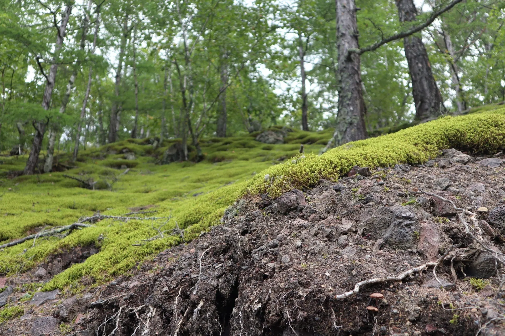
Laohei Mountain (老黑山, Lǎohēi Shān)
The star attraction — a 515.9-meter volcanic cone that erupted in 1719-1721, creating the lava flows that dammed the lakes. The crater is 350 meters in diameter and 145 meters deep, with a walking path around the rim offering views across the entire five-lake chain. The climb is moderate (about 40 minutes on well-paved steps). The lava field at the base — ropey pahoehoe, pressure ridges, and lava tubes — is the best-preserved young volcanic surface in China. ¥80 (included in geopark pass) as of June 2026.
Wikimedia Commons · CC-BY-SA
Yaoquan Mountain (药泉山, Yàoquán Shān)
The "Medicine Spring Mountain," the center of Wudalianchi's mineral-water culture. The mountain itself is a small volcanic cone, but the draw is the cluster of mineral-water springs at its base — the North Spring (北泉, Běi Quán), South Spring (南泉, Nán Quán), and Fanhua Spring (翻花泉) — each with a different mineral profile. Locals and Russian visitors fill bottles directly from the taps and drink the cold, naturally carbonated water for its supposed digestive and metabolic benefits. ¥30 for spring access as of June 2026.
Wikimedia Commons · CC-BY-SA
Crystal Palace — Lava Cave (水晶宫/冰洞, Shuǐjīng Gōng / Bīng Dòng)
A lava tube cave where the temperature stays below freezing year-round — even in August, when outside temperatures hit 30°C, the cave interior is a steady -5 to -12°C. Ice formations coat the walls and ceiling, creating a surreal frozen world inside a volcanic landscape. The cave is artificially lit and has a boardwalk. ¥30 as of June 2026. Bring a jacket — the temperature shock from summer heat to subzero is dramatic.
Wikimedia Commons · CC-BY-SA
North Spring (北泉, Běi Quán)
The most famous of the mineral springs, located at the base of Yaoquan Mountain. The water emerges cold (2-4°C year-round), naturally carbonated, and rich in iron, silica, and trace elements. Locals drink it directly from the tap, and the surrounding park has a mineral-water swimming pool (cold, 2-8°C) where bathers soak for therapeutic purposes — the experience is intense (the water is very cold) and is believed to help with skin conditions and arthritis. ¥20 for drinking access, ¥60 for the bathing pool as of June 2026.
Wikimedia Commons · CC-BY-SA
Wudalianchi Geological Museum (五大连池地质博物馆)
A well-designed modern museum (renovated 2018) explaining the volcanic geology of the region, with exhibits on lava types, the 1719-1721 eruption, the formation of the five lakes, and the mineral-water system. Labels are in Chinese and English, and the exhibits include lava samples, interactive volcano models, and a film about the eruption. Free with geopark entry ticket. Allow 1-1.5 hours. The best place to understand what you're looking at before heading to the sites.
Wikimedia Commons · CC-BY-SA
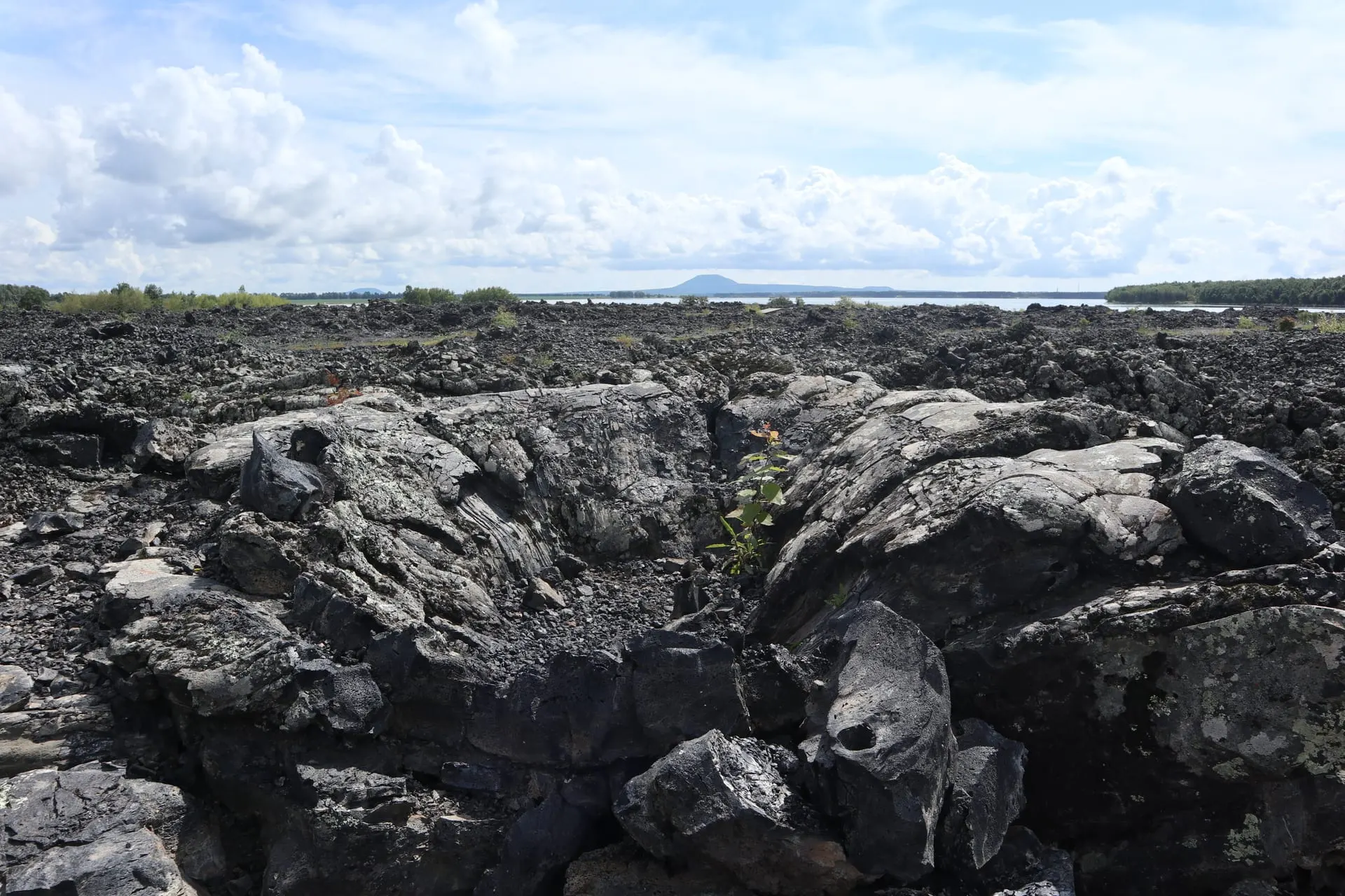
Longmen Stone Village (龙门石寨, Lóngmén Shí Zhài)
A vast field of basalt boulders and lava blocks spread across several square kilometers, the result of an older volcanic eruption (estimated 200,000-300,000 years ago). The stone field looks like a frozen black sea, with hardy birch and pine trees growing from cracks in the lava. A boardwalk crosses the field. The site is at its most dramatic in autumn, when the birch leaves turn gold against the black stone. ¥50 as of June 2026.
Wikimedia Commons · CC-BY-SA
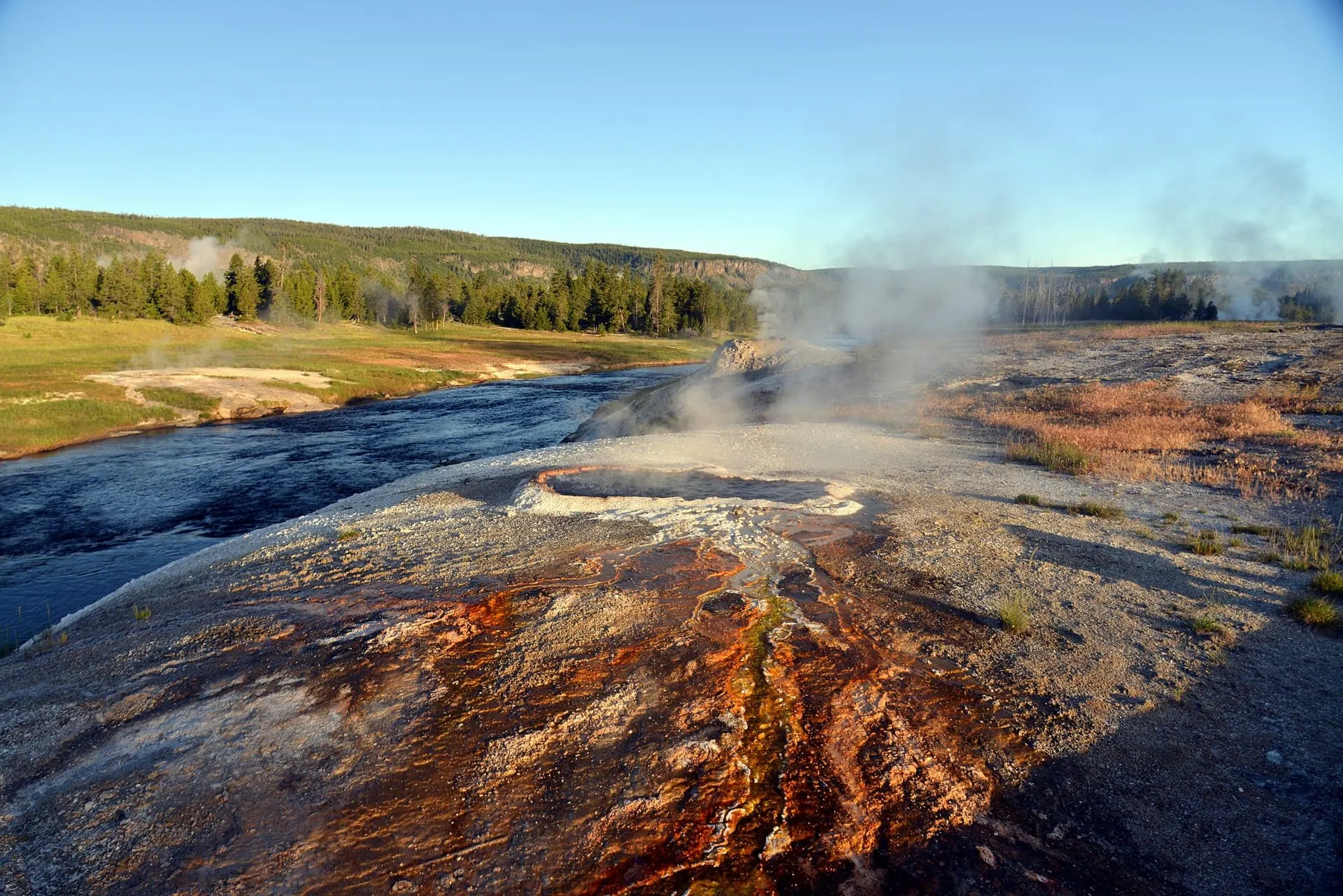
South Spring (南泉, Nán Quán)
The second of the two main mineral springs at Yaoquan Mountain, with a different mineral profile from the North Spring — higher in silica, lower in iron. The South Spring is the traditional bathing spring, with separate male and female cold-water pools. The water temperature (2-6°C) makes for a bracingly cold soak, and the ritual — 15-20 minutes in the water, then rest in the sun — is followed by locals who believe in its therapeutic benefits for skin and joint conditions. ¥20 for drinking, ¥60 for bathing as of June 2026.
Wikimedia Commons · CC-BY-SA
STAY
Where to stay in Wudalianchi
Pick a base that matches the trip you want — imperial-central for sightseeing, hutong belt for character, Chaoyang for nightlife, or Qianmen for budget.
Geopark Scenic Area
Most convenient base — near the visitor center, Laohei Mountain, and the mineral springs, with the best selection of hotels and restaurants
#geopark-scenic-areaYaoquan Mountain Spring Zone
The heart of mineral-water culture — sanatoria, spring taps, bathing pools, and the strongest Russian presence
#yaoquan-spring-zoneWudalianchi Town (五大连池市)
The administrative town 20 km from the geopark — wider hotel selection and local restaurants, but a 30-minute drive to sites
#wudalianchi-townFive Lakes Shoreline
Scattered guesthouses along the lakes — the quietest base, best for sunrise over the water and lake access
#lake-district
ITINERARIES
Sample itineraries from Wudalianchi
Three ready-made routes, from a 1-day imperial sprint to a 5-day deep dive. Copy the day-by-day plan and adapt to your own pace.
- 1 DAY
One-Day Wudalianchi Sprint
Covers the essential volcanic and mineral-spring highlights. Feels rushed but doable with an early start.
- Travelers on a tight schedule
- Geology enthusiasts with limited time
- Those combining with a Harbin trip
- Day 01
Morning
Geological Museum at 08:00 (1 hour). Laohei Mountain — climb to crater rim and walk the lava field (2-3 hours).
Afternoon
Lunch at a geopark restaurant. Yaoquan Mountain mineral springs — drink from the North Spring, visit the South Spring, try a cold bath if brave (2 hours). Crystal Palace ice cave (30 minutes).
Evening
Drive back to Harbin (depart by 16:00, arrive 20:00-21:00) or overnight in Wudalianchi town.
- 2 DAYS
Two-Day Classic Wudalianchi
The recommended visit — all major sites at a comfortable pace with time for the mineral-water culture.
- Most visitors
- First-time Wudalianchi travelers
- Those wanting geology + mineral springs
- Day 01
Morning
Geological Museum (1 hour). Laohei Mountain climb and lava field (2-3 hours). Lunch at a geopark restaurant.
Afternoon
Yaoquan Mountain — North and South Springs, mineral-water drinking, optional cold bath (2-3 hours). Crystal Palace ice cave (30 minutes).
Evening
Overnight at a sanatorium or geopark hotel. Dinner: mineral-water tofu and lake fish at a local restaurant.
- Day 02
Morning
Longmen Stone Village in early light (2 hours). Drive to the Third Lake for shoreline walk and optional boating (1-2 hours).
Afternoon
Return to the springs for a final mineral-water soak. Visit Fanhua Spring for a quieter spring experience. Depart by late afternoon.
Evening
Drive back to Harbin (arrive 20:00-21:00) or continue to Heihe for the Russian border experience.
- 3 DAYS
Three-Day Immersive Volcano + Springs
The full Wudalianchi experience — all major sites, smaller volcanic cones, and time to settle into the mineral-water rhythm.
- Geology and landscape enthusiasts
- Slow travelers
- Those who want the complete experience
- Day 01
Morning
Geological Museum (1 hour). Laohei Mountain — full crater rim walk and lava field exploration (3 hours).
Afternoon
Lunch. Yaoquan Mountain springs — North Spring drinking, South Spring bathing (2-3 hours). Crystal Palace ice cave (30 minutes).
Evening
Check into a sanatorium. Evening walk around the spring zone. Dinner at the sanatorium canteen or a local restaurant.
- Day 02
Morning
Longmen Stone Village (2 hours) in morning light. Drive to Huoshao Mountain — the quieter sibling volcano, fewer visitors, more rugged (2 hours).
Afternoon
Lunch. Third Lake — boating and shoreline walk (1-2 hours). Afternoon return to the springs for a second round of mineral water and bathing.
Evening
Dinner at a local Dongbei barbecue restaurant. Evening walk along the lake shore.
- Day 03
Morning
Wohu Mountain (Crouching Tiger Mountain) — an older volcanic cone with forest growing in its crater, beautiful contrast with the barren Laohei lava (2 hours). Visit the Wudalianchi town market for local products — mineral water, volcanic mud skincare, local honey.
Afternoon
Final spring visit for a last drink and soak. Lunch. Depart for Harbin or Heihe by early afternoon.
Evening
Arrive Harbin by evening. Optional: Harbin Russian dinner and Zhongyang Street evening walk.
BUDGET
What a Wudalianchi trip costs
Per-person, per-day costs across three spending tiers. Excludes international flights and visa fees.
| Line item | Backpacker | Mid-range | Luxury |
|---|---|---|---|
| Geopark comprehensive entry pass | $34 | $34 | $34 |
| Individual site fees (springs, ice cave, Stone Village) | $15 | $15 | $15 |
| Private car and driver (per day) | $50 | $60 | $70 |
| Budget guesthouse / sanatorium (per night) | $18 | $0 | $0 |
| Mid-range hotel (per night) | $0 | $35 | $0 |
| Best available hotel (per night) | $0 | $0 | $70 |
| Local restaurant meal | $4 | $7 | $12 |
| Mineral spring water (drinking) | $3 | $3 | $3 |
| Mineral spring bathing pool | $8 | $8 | $8 |
| Miscellaneous (snacks, water, insect repellent) | $5 | $5 | $8 |
| Total per day | $137 | $167 | $220 |
$ USD per person per day, before international flights and visas. Last verified: Q3 2026.
STAY SAFE
Emergency contacts in Wudalianchi
Save these three numbers before you board the plane. China uses different hotlines than most countries — there's no 911.
- POLICE
110
- AMBULANCE
120
- FIRE
119
- TOURIST HOTLINE
0456-7222222 (Wudalianchi Scenic Area Administration)
- ENGLISH-SPEAKING ER
Wudalianchi People's Hospital (五大连池市人民医院) in Wudalianchi town — 30 min from geopark; limited English; critical cases evacuated to Harbin (4-5 hours)
Problems travelers hit in Wudalianchi
- Why is my Alipay not working?You linked a foreign Visa or Mastercard to Alipay but every transaction is rejected at the merchant.
- My China visa was denied — what now?Your L visa application was refused at the Chinese consulate and your trip is in 2–4 weeks.
- My passport was lost or stolen in China — what do I do?Your passport is gone (theft or loss) and you're in mainland China without travel documents.
- Why can't I book on 12306 with my foreign card?You tried to book a high-speed rail ticket on 12306.cn and your foreign Visa/Mastercard is rejected at checkout.
- Why is my VPN not working in China?You arrived in China, opened your VPN, and it will not connect at all or connects but no traffic loads.
- Why can't I book a Tibet trip on my own?You try to book Lhasa flights and hotels yourself but the booking fails, or you're turned away at the Lhasa airport without a permit.
Book activities in Wudalianchi
These are licensed tour operators and booking platforms we've vetted independently. Booking through these links may earn us a commission — see our affiliate disclosure. This never affects our editorial recommendations or the price you pay.
Frequently asked questions
Is Wudalianchi worth visiting?
How do I get to Wudalianchi from Harbin?
How many days do I need in Wudalianchi?
What is the mineral water like?
Can I swim in the five lakes?
When is the best time to visit Wudalianchi?
Show all 20 FAQs
Do I need a guide for Wudalianchi?
Are there really Russian visitors at Wudalianchi?
What should I pack for Wudalianchi?
Is Wudalianchi suitable for children?
Can I visit Wudalianchi in winter?
What is the connection between Wudalianchi and Harbin's ice festival?
Is Wudalianchi safe for foreign tourists?
How is Wudalianchi different from other volcanic sites in China?
Can I drink the tap water in Wudalianchi?
Is Wudalianchi really worth the long trip?
When is the best time to visit Wudalianchi?
How do I get to Wudalianchi?
What is the volcanic landscape like?
How long should I plan for Wudalianchi?
References

Related guides & destinations
Guide
How We Research 2026: NihaoVisit’s Methodology for China Travel Information
How NihaoVisit sources, verifies, and maintains 700+ pages of China travel information — our source hierarchy, fact-checking process, update
Guide
Fact-Checking Log 2026: Verified China Travel Information — NihaoVisit
A public log of fact-checking verification passes on NihaoVisit, showing what was verified, when, and against which sources — covering visa
Guide
Best Time to Visit China 2026: Month-by-Month Weather, Crowds, and Prices
The best time to visit most of China is April–May and September–October. Winter (Dec–Feb) is cold but cheap; summer (Jun–Aug) is hot and cro
Guide
VPN for China 2026: Which VPNs Work, eSIM Alternatives, and the Complete Pre-Trip Checklist
Most Western apps and websites are blocked in mainland China. A reliable VPN is essential for Google, Gmail, WhatsApp, Instagram, and most n
Guide
China SIM Card and eSIM Guide 2026: Stay Connected Without WeChat
A Chinese SIM or eSIM lets you use mobile data, maps, and ride-hailing without WiFi. Here is how to get one, the cost, and which provider to
Guide
Solo Female Travel in China 2026: Safety, Tips, and Real Experiences
China is one of the safer destinations for solo female travelers. Petty theft is rare, violent crime against tourists is extremely uncommon,